Frituur ‘t Sjoenbeekske
Frituur ‘t Sjoenbeekske is a fast food restaurant in Limburg, Flanders. Frituur ‘t Sjoenbeekske is situated nearby to the sports venue Sporthal Beterveld, as well as near the community center Jeugdhuis Schoonbeek.| Tap on a place to explore it |
Places of Interest Nearby
Highlights include Onze-Lieve-Vrouw Maagd der Armenkerk (Schoonbeek) and Waterkasteel van Schoonbeek.
Onze-Lieve-Vrouw Maagd der Armenkerk (Schoonbeek)
Church

Photo: Paul Hermans, CC BY-SA 4.0.
Onze-Lieve-Vrouw Maagd der Armenkerk (Schoonbeek) is a church, which is situated 320 metres east of Frituur ‘t Sjoenbeekske.
Waterkasteel van Schoonbeek
Castle

Photo: Paul Hermans, CC BY-SA 3.0.
Waterkasteel van Schoonbeek is a castle, which is situated 1 km southeast of Frituur ‘t Sjoenbeekske.
Nieuwbeekmolen
Watermill

Photo: Eebie, CC BY-SA 4.0.
Nieuwbeekmolen is a watermill, which is situated 600 metres southwest of Frituur ‘t Sjoenbeekske.
Places in the Area
Nearby places include Diepenbeek and Onze-Lieve-Vrouw.
Diepenbeek
Town

Photo: Paul Hermans, CC BY-SA 3.0.
Diepenbeek is a municipality located in the Belgian province of Limburg near Hasselt. On January 1, 2012, Diepenbeek had a total population of 18,337. Its total area is 41.19 km2 which gives a population density of 430 inhabitants per square kilometre. Diepenbeek is situated 3½ km west of Frituur ‘t Sjoenbeekske.
Onze-Lieve-Vrouw
Hamlet
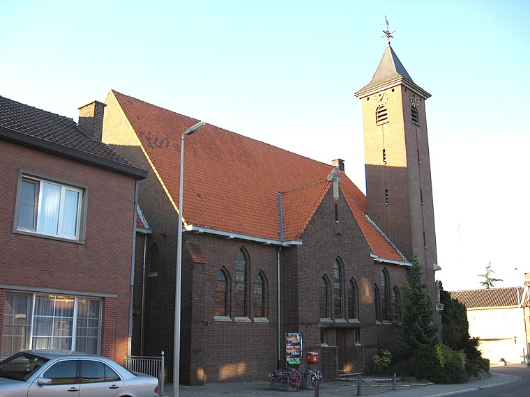
Photo: Sonuwe, CC BY-SA 3.0.
Onze-Lieve-Vrouw is a hamlet, which is situated 4 km south of Frituur ‘t Sjoenbeekske.
Munsterbilzen
Village
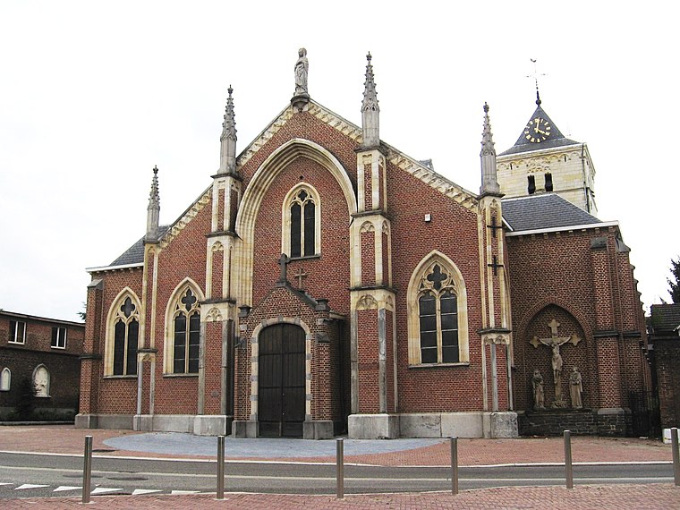
Photo: Sonuwe, CC BY-SA 3.0.
Munsterbilzen is a village, which is situated 4½ km southeast of Frituur ‘t Sjoenbeekske.
Frituur ‘t Sjoenbeekske
- Type: Fast food restaurant
- Cuisine: friture
- Categories: food and restaurant
- Location: Limburg, Flanders, Belgium, Benelux, Europe
- View on OpenStreetMap
Latitude
50.90442° or 50° 54′ 16″ northLongitude
5.46893° or 5° 28′ 8″ eastOpen location code
9F27WF39+QHOpenStreetMap ID
node 9951264306OpenStreetMap feature
amenity=fast_foodOpenStreetMap attribute
cuisine=friture
This page is based on OpenStreetMap, Wikidata, and Wikimedia Commons.
We’d love your help improving our open data sources. Thank you for contributing.
Satellite Map
Discover Frituur ‘t Sjoenbeekske from above in high-definition satellite imagery.
Notable Places Nearby
Highlights include Sporthal Beterveld and Jeugdhuis Schoonbeek.
Nearby Places
Explore places such as Seniorie Hortensia and Basisschool De Wilg.
Limburg: Must-Visit Destinations
Delve into Sint-Truiden, Hasselt, Tongeren, and Genk.
Curious Fast Food Restaurants to Discover
Uncover intriguing fast food restaurants from every corner of the globe.
About Mapcarta. Data © OpenStreetMap contributors and available under the Open Database License". Text is available under the CC BY-SA 4.0 license, except for photos, directions, and the map. Photo: Paul Hermans, CC BY-SA 3.0.