C’est mon donuts
C’est mon donuts is a fast food restaurant in Paris, Île-de-France. C’est mon donuts is situated nearby to the health club The Well, as well as near the social service facility Centre d’accueil de jour Marie de Miribel.| Tap on a place to explore it |
Places of Interest Nearby
Highlights include Bataclan and Jardin Louise-Talbot-et-Augustin-Avrial.
Bataclan
Theater building
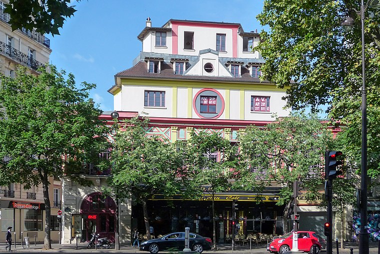
Photo: Wikimedia, CC BY-SA 3.0.
The Bataclan is a theatre located at 50 Boulevard Voltaire in the 11th arrondissement of Paris, France. Designed in 1864 by the architect Charles Duval, its name refers to Ba-ta-clan, an operetta by Jacques Offenbach. Bataclan is situated 530 metres northwest of C’est mon donuts.
Jardin Louise-Talbot-et-Augustin-Avrial
Park

Photo: Chabe01, CC BY-SA 4.0.
Jardin Louise-Talbot-et-Augustin-Avrial is a park, which is situated 110 metres south of C’est mon donuts.
Opéra Bastille
Theater building

Photo: Guilhem Vellut, CC BY 2.0.
The Opéra Bastille is a modern opera house in the 12th arrondissement of Paris, France. Inaugurated in 1989 as part of President François Mitterrand's Grands Travaux, it became the main facility of the Paris National Opera, France's principal opera company… Opéra Bastille is situated 1 km south of C’est mon donuts.
Places in the Area
Nearby places include 11th arrondissement and Faubourg Saint-Antoine.
11th arrondissement

Photo: ParisSharing, CC BY 2.0.
The 11th Arrondissement is home to two quite different but equally blossoming centres of Parisian nightlife. The streets just northwest of Place de la Bastille are full of little bars which attract a mix of young suburban Parisians, expats, and foreigners.
Faubourg Saint-Antoine
Suburb

Photo: Jean-François Gornet, CC BY-SA 2.0.
The Faubourg Saint-Antoine was one of the traditional suburbs of Paris, France. It grew up to the east of the Bastille around the abbey of Saint-Antoine-des-Champs, and ran along the Rue du Faubourg Saint-Antoine.
Marais
Suburb

Photo: Luctor IV, Public domain.
The Marais is a historic district in Paris, France. It spreads across parts of the 3rd and 4th arrondissements on the Rive Droite, or Right Bank, of the Seine.
C’est mon donuts
- Type: Fast food restaurant
- Cuisine: donut
- Categories: food and restaurant
- Location: Paris, Île-de-France, France, Europe
- View on OpenStreetMap
Latitude
48.85931° or 48° 51′ 34″ northLongitude
2.37527° or 2° 22′ 31″ eastOpen location code
8FW4V95G+P4OpenStreetMap ID
node 9968299619OpenStreetMap feature
amenity=fast_foodOpenStreetMap attribute
cuisine=donut
This page is based on OpenStreetMap, Wikidata, and Wikimedia Commons.
We’d love your help improving our open data sources. Thank you for contributing.
Satellite Map
Discover C’est mon donuts from above in high-definition satellite imagery.
Notable Places Nearby
Highlights include The Well and Centre d’accueil de jour Marie de Miribel.
Nearby Places
Explore places such as Pizza Unica and Fastnfone.
Paris: Must-Visit Destinations
Delve into La Défense, 1st arrondissement, 7th arrondissement, and 8th arrondissement.
Curious Fast Food Restaurants to Discover
Uncover intriguing fast food restaurants from every corner of the globe.
About Mapcarta. Data © OpenStreetMap contributors and available under the Open Database License". Text is available under the CC BY-SA 4.0 license, except for photos, directions, and the map. Photo: Benh, CC BY-SA 4.0.