Downside Nursery School
Downside Nursery School is a kindergarten in Elmbridge District, Surrey, England which is located on Downside Road. Downside Nursery School is situated nearby to the pub The Cricketers Inn, as well as near St Matthew’s CofE Aided Infant School, Cobham.| Tap on a place to explore it |
Places of Interest Nearby
Highlights include The Cricketers Inn and St Michael’s Chapel.
The Cricketers Inn
Pub

Photo: Colin Smith, CC BY-SA 2.0.
The Cricketers Inn is a pub, which is situated 340 feet east of Downside Nursery School.
St Michael’s Chapel
Church

Photo: Hassocks5489, CC0.
St Michael’s Chapel is a church, which is situated 1,400 feet east of Downside Nursery School.
Cobham Mill
Museum

Photo: Colin Smith, CC BY-SA 2.0.
Cobham Mill is a museum, which is situated 1 mile north of Downside Nursery School.
Places in the Area
Nearby places include Cobham Park and Hatchford.
Cobham Park
Locality
Cobham Park is a former mansion and country estate in Cobham, Surrey, England. The main house was converted to apartments in the early 2000s, but the majority of the surrounding former parkland remains undeveloped.
Hatchford
Village

Photo: Wikimedia, Public domain.
Hatchford is a hamlet in the English county of Surrey outside the town of Cobham; it traditionally includes the contiguous hamlet of Pointers Green.
Cobham
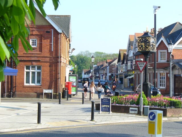
Photo: Colin Smith, CC BY-SA 2.0.
Cobham is a village of 9,700 people in Surrey on the River Mole. It includes a commercial High Street area with a remaining 18th-century English landscape park.
Downside Nursery School
- Type: Kindergarten
- Address: Downside Road, Downside, Cobham, KT11 3NA
- Category: education
- Location: Elmbridge District, Surrey, South East England, England, United Kingdom, Britain and Ireland, Europe
- View on OpenStreetMap
Latitude
51.31189° or 51° 18′ 43″ northLongitude
-0.41229° or 0° 24′ 44″ westOpen location code
9C3X8H6Q+Q3OpenStreetMap ID
way 1023607070OpenStreetMap feature
amenity=kindergarten
This page is based on OpenStreetMap, Wikidata, and Wikimedia Commons.
We’d love your help improving our open data sources. Thank you for contributing.
Satellite Map
Discover Downside Nursery School from above in high-definition satellite imagery.
Notable Places Nearby
Highlights include St Matthew’s CofE Aided Infant School, Cobham and Downside Village Hall.
Nearby Places
Explore places such as Middleton Road and Cossins Farm.
Surrey: Must-Visit Destinations
Delve into Guildford, Woking, Godalming, and Epsom.
Curious Kindergartens to Discover
Uncover intriguing kindergartens from every corner of the globe.
About Mapcarta. Data © OpenStreetMap contributors and available under the Open Database License". Text is available under the CC BY-SA 4.0 license, except for photos, directions, and the map. Photo: Wikimedia, CC0.