Logistics Valley Flanders
Logistics Valley Flanders is in Limburg, Flanders. Logistics Valley Flanders is situated nearby to the hamlet Langerlo, as well as near the village Munsterbilzen.| Tap on a place to explore it |
Places of Interest Nearby
Highlights include Sint-Jozefskerk and Yunus Emre-moskee.
Sint-Jozefskerk
Church

Photo: Sonuwe, CC BY-SA 3.0.
Sint-Jozefskerk is a church, which is situated 1½ km northeast of Logistics Valley Flanders.
Yunus Emre-moskee
Mosque

Photo: Adelbrecht82, CC BY-SA 3.0.
Yunus Emre-moskee is a mosque, which is situated 1½ km northeast of Logistics Valley Flanders.
Maria Moeder van de Kerk
Church

Photo: Sonuwe, CC BY-SA 3.0.
Maria Moeder van de Kerk is a church, which is situated 2½ km north of Logistics Valley Flanders.
Places in the Area
Nearby places include Langerlo and Genk.

Genk

Photo: Winny Biets, CC BY 4.0.
Genk is a municipality and city located in the Belgian province of Limburg near Hasselt. The municipality comprises only the town of Genk itself. It is one of the most important industrial towns in Flanders, located on the Albert Canal, between Antwerp and Liège.
Munsterbilzen
Village
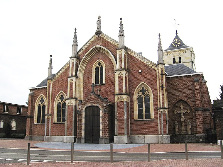
Photo: Sonuwe, CC BY-SA 3.0.
Munsterbilzen is a village, which is situated 4½ km south of Logistics Valley Flanders.
Logistics Valley Flanders
Latitude
50.92594° or 50° 55′ 33″ northLongitude
5.50664° or 5° 30′ 24″ eastOpen location code
9F27WGG4+9MOpenStreetMap ID
way 1029331661OpenStreetMap feature
landuse=industrial
This page is based on OpenStreetMap, Wikidata, and Wikimedia Commons.
We’d love your help improving our open data sources. Thank you for contributing.
Satellite Map
Discover Logistics Valley Flanders from above in high-definition satellite imagery.
Notable Places Nearby
Highlights include Expo Euro-Serre and Genker Watersport Vereniging.
Nearby Places
Explore places such as H.Essers and relict Fordsite.
Limburg: Must-Visit Destinations
Delve into Sint-Truiden, Hasselt, Tongeren, and Genk.
Curious Places to Discover
Uncover intriguing places from every corner of the globe.
About Mapcarta. Data © OpenStreetMap contributors and available under the Open Database License". Text is available under the CC BY-SA 4.0 license, except for photos, directions, and the map. Photo: Paul Hermans, CC BY-SA 3.0.