Kapel van het Crijt
Kapel van het Crijt is a church in Diepenbeek, Hasselt, Flanders. Kapel van het Crijt is situated nearby to the community center Buurthuis Terlogt, as well as near the village Kortessem.| Tap on a place to explore it |
Places of Interest Nearby
Highlights include Sint-Servatiuskerk and Diepenbeek Castle.
Sint-Servatiuskerk
Church

Photo: Reinhardhauke, CC BY-SA 3.0.
Sint-Servatiuskerk is a church, which is situated 1½ km north of Kapel van het Crijt.
Diepenbeek Castle
Castle

Photo: Paul Hermans, CC BY-SA 3.0.
Diepenbeek Castle is a castle in Diepenbeek near Hasselt in the province of Limburg, Belgium. The building consists of a 15th-century keep with a 17th-century main block. Diepenbeek Castle is situated 2 km north of Kapel van het Crijt.
Diepenbeek railway station
Railway stop

Photo: Sonuwe, CC BY-SA 3.0.
Diepenbeek railway station is a railway stop on the Hasselt–Liège railway in the Belgian municipality of Diepenbeek. The station was opened in 1856 along the new railway line between Hasselt and Maastricht. Diepenbeek railway station is situated 2 km north of Kapel van het Crijt.
Places in the Area
Nearby places include Kortessem and Romershoven.
Kortessem
Village

Photo: Sonuwe, CC BY-SA 3.0.
Kortessem is a former municipality located in the Belgian province of Limburg near Hasselt. On January 1, 2006, Kortessem had a total population of 8,074. Kortessem is situated 4½ km southwest of Kapel van het Crijt.
Romershoven
Village

Photo: Sonuwe, CC BY-SA 3.0.
Romershoven is a village, which is situated 5 km southeast of Kapel van het Crijt.
Onze-Lieve-Vrouw
Hamlet
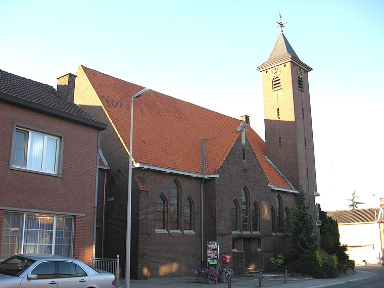
Photo: Sonuwe, CC BY-SA 3.0.
Onze-Lieve-Vrouw is a hamlet, which is situated 5 km southeast of Kapel van het Crijt.
Kapel van het Crijt
- Type: Church
- Denomination: Roman Catholic
- Categories: building, chapel, historic site, place of worship, and religion
- Location: Diepenbeek, Hasselt, Limburg, Flanders, Belgium, Benelux, Europe
- View on OpenStreetMap
Latitude
50.89476° or 50° 53′ 41″ northLongitude
5.42084° or 5° 25′ 15″ eastInception
18th centuryOpen location code
9F27VCVC+W8OpenStreetMap ID
way 1034885561OpenStreetMap feature
amenity=place_of_worshipOpenStreetMap feature
building=chapelOpenStreetMap feature
historic=yesOpenStreetMap attribute
denomination=roman_catholic
This page is based on OpenStreetMap, Wikidata, and Wikimedia Commons.
We’d love your help improving our open data sources. Thank you for contributing.
Satellite Map
Discover Kapel van het Crijt from above in high-definition satellite imagery.
Notable Places Nearby
Highlights include Buurthuis Terlogt and Sint-Rochuskapel.
Nearby Places
Explore places such as Wisemen and Aquablockers.
Limburg: Must-Visit Destinations
Delve into Sint-Truiden, Tongeren, Genk, and Maasmechelen.
Curious Churches to Discover
Uncover intriguing churches from every corner of the globe.
About Mapcarta. Data © OpenStreetMap contributors and available under the Open Database License". Text is available under the CC BY-SA 4.0 license, except for photos, directions, and the map. Photo: Jeanhousen, CC BY 3.0.