Pondgully Wood
Pondgully Wood is a forest in Inkpen, West Berkshire, England. Pondgully Wood is situated nearby to the village Inkpen, as well as near Kintbury.| Tap on a place to explore it |
Places of Interest
Highlights include Inkpen Crocus Field and Kintbury railway station.
Inkpen Crocus Field
Nature reserve
Inkpen Crocus Fields is a 3.1-hectare biological Site of Special Scientific Interest near Inkpen in Berkshire. It is managed by the Berkshire, Buckinghamshire and Oxfordshire Wildlife Trust.
Kintbury railway station
Railway station

Photo: Ben Brooksbank, CC BY-SA 2.0.
Kintbury railway station serves the village of Kintbury in Berkshire, England. It is situated on the Reading to Taunton Line, 58 miles 38 chains from London Paddington.
Kintbury Newt Ponds
Nature reserve
Kintbury Newt Ponds is a 3-hectare nature reserve in Kintbury in Berkshire. It is managed by the Berkshire, Buckinghamshire and Oxfordshire Wildlife Trust. The reserve is made up of several ponds, reedbed, scrub and grassland.
Places in the Area
Nearby places include Hungerford and Kintbury.
Hungerford
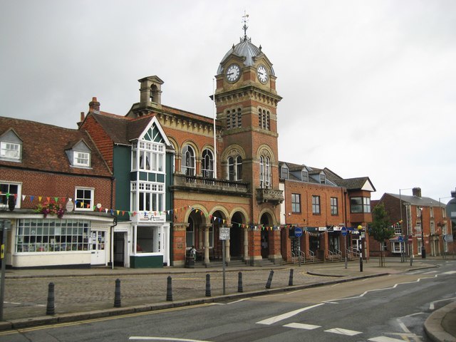
Photo: Nigel Cox, CC BY-SA 2.0.
Hungerford is a historic market town and civil parish in Berkshire, England, 8 miles west of Newbury, 9 miles east of Marlborough, and 60 miles west of London.
Kintbury
Village

Photo: Pam Brophy, CC BY-SA 2.0.
Kintbury is a village and civil parish in the West Berkshire district, Berkshire, England, between the towns of Newbury and Hungerford. The village has a convenient railway to Paddington and Reading, proximity to other transport and local cultural…
West Woodhay
Village

Photo: Michael FORD, CC BY-SA 2.0.
West Woodhay is a rural scattered village and civil parish in West Berkshire, England. At the 2011 census it had 59 households.
Pondgully Wood
- Type: Forest
- Location: Inkpen, West Berkshire, England, United Kingdom, Britain and Ireland, Europe
- View on OpenStreetMap
Latitude
51.3874° or 51° 23′ 15″ northLongitude
-1.4723° or 1° 28′ 20″ westOpen location code
9C3W9GPH+X3OpenStreetMap ID
way 1056331654OpenStreetMap feature
natural=wood
This page is based on OpenStreetMap, Wikidata, and Wikimedia Commons.
We’d love your help improving our open data sources. Thank you for contributing.
Satellite Map
Discover Pondgully Wood from above in high-definition satellite imagery.
Localities in the Area
Explore places such as Inkpen and Upper Green.
Notable Places Nearby
Highlights include Cherrytree Copse and Follygully Copse.
England: Must-Visit Destinations
Delve into London, Manchester, Sheffield, and Leeds.
Curious Forests to Discover
Uncover intriguing forests from every corner of the globe.
About Mapcarta. Data © OpenStreetMap contributors and available under the Open Database License". Text is available under the CC BY-SA 4.0 license, except for photos, directions, and the map. Photo: sidibousaid, CC BY 2.0.