Stockingfield Bridge
Stockingfield Bridge is a bridge in Glasgow City, Scotland. Stockingfield Bridge is situated nearby to the bridge Stockingfield Aqueduct, as well as near Stockingfield Park.| Tap on a place to explore it |
Places of Interest Nearby
Highlights include Stockingfield Aqueduct and Lochburn Park.
Stockingfield Aqueduct
Bridge

Photo: Alec MacKinnon, CC BY-SA 2.0.
Stockingfield Aqueduct is a bridge.
Lochburn Park
Stadium
Lochburn Park is a football stadium in the Maryhill area of Glasgow, Scotland. It is the home ground Maryhill F.C. of the Scottish Junior Football Association West Region, who have played there since the late 19th century. Lochburn Park is situated 700 feet southwest of Stockingfield Bridge.
Gilshochill railway station
Railway station

Photo: G Laird, CC BY-SA 2.0.
Gilshochill railway station is a railway station serving the Gilshochill, Maryhill and Cadder areas of Glasgow, Scotland. The station is located on the Maryhill Line, 31⁄4 miles north west of Glasgow Queen Street. Gilshochill railway station is situated 1,900 feet north of Stockingfield Bridge.
Places in the Area
Nearby places include Gilshochill and Maryhill.
Gilshochill
Quarter
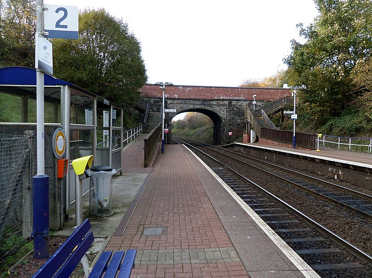
Photo: Rosser1954, CC BY-SA 4.0.
Gilshochill is located to the north west of Maryhill in the city of Glasgow, Scotland. Immediately north of Maryhill basin and Maryhill locks, it is the district where the Bowling and Port Dundas branches of the Forth and Clyde Canal meet at Stockingfield Junction.
Maryhill
Suburb
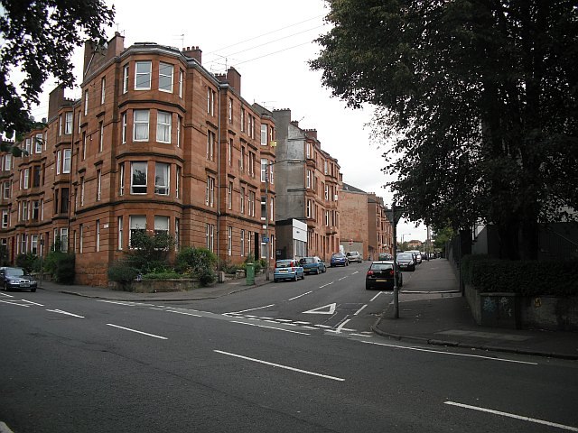
Photo: Richard Webb, CC BY-SA 2.0.
Maryhill is an area in the north-west of Glasgow in Scotland. A former independent burgh and the heart of an eponymous local authority ward, its territory is bisected by Maryhill Road, part of the A81 road which runs for a distance of roughly three miles between Glasgow city centre and the suburban town of Bearsden.
Wyndford
Quarter

Photo: Lairich Rig, CC BY-SA 2.0.
Wyndford is an area of the city of Glasgow, Scotland. Located two miles northwest of the city centre in Maryhill, Wyndford is bounded by Maryhill Road to the north and the River Kelvin to the south.
Stockingfield Bridge
- Type: Bridge
- Category: transportation
- Location: Glasgow City, Scotland, United Kingdom, Britain and Ireland, Europe
- View on OpenStreetMap
Latitude
55.89244° or 55° 53′ 33″ northLongitude
-4.28576° or 4° 17′ 9″ westOpen location code
9C7QVPR7+XMOpenStreetMap ID
way 1119402463OpenStreetMap feature
man_made=bridge
This page is based on OpenStreetMap, Wikidata, and Wikimedia Commons.
We’d love your help improving our open data sources. Thank you for contributing.
Satellite Map
Discover Stockingfield Bridge from above in high-definition satellite imagery.
Notable Places Nearby
Highlights include Stockingfield Park and maryhill Ironworks.
Nearby Places
Explore places such as The Comedy Unit and Enclosure.
Scotland: Must-Visit Destinations
Delve into Edinburgh, Glasgow, Aberdeen, and Dundee.
Curious Bridges to Discover
Uncover intriguing bridges from every corner of the globe.
About Mapcarta. Data © OpenStreetMap contributors and available under the Open Database License". Text is available under the CC BY-SA 4.0 license, except for photos, directions, and the map. Photo: Ritchyblack, FAL.