Pieve di Sant’Eracliano
Pieve di Sant’Eracliano is a ruins in Montelabbate, Pesaro and Urbino, Marche. Pieve di Sant’Eracliano is situated nearby to the village Colbordolo, as well as near Montefabbri.| Tap on a place to explore it |
Places in the Area
Nearby places include Colbordolo and Montefabbri.
Colbordolo
Village

Photo: Toni Pecoraro, Public domain.
Colbordolo is a frazione of the comune of Vallefoglia in the Province of Pesaro e Urbino in the Italian region Marche. It was a separate comune until 2013. Colbordolo is situated 3½ km northwest of Pieve di Sant’Eracliano.
Montefabbri
Village

Photo: Zlatan88, CC BY-SA 3.0.
Montefabbri is a village, which is situated 4½ km west of Pieve di Sant’Eracliano.
Sant’Angelo in Lizzola
Village
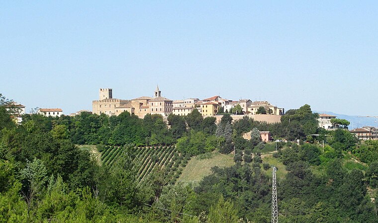
Photo: Toni Pecoraro, Public domain.
Sant'Angelo in Lizzola is a frazione of the comune of Vallefoglia in the province of Pesaro e Urbino in the Italian region Marche. It was a separate comune until 2013. The main parish church is the former collegiate church of San Michele Arcangelo. Sant’Angelo in Lizzola is situated 5 km northeast of Pieve di Sant’Eracliano.
Pieve di Sant’Eracliano
- Type: Ruins
- Category: historic site
- Location: Montelabbate, Pesaro and Urbino, Marche, Central Italy, Italy, Europe
- View on OpenStreetMap
Latitude
43.7996° or 43° 47′ 59″ northLongitude
12.75158° or 12° 45′ 6″ eastOpen location code
8FMJQQX2+RJOpenStreetMap ID
way 1154270918OpenStreetMap feature
historic=ruins
This page is based on OpenStreetMap, Wikidata, and Wikimedia Commons.
We’d love your help improving our open data sources. Thank you for contributing.
Satellite Map
Discover Pieve di Sant’Eracliano from above in high-definition satellite imagery.
Notable Places Nearby
Highlights include Chiesa di San Martino and Municipio di Petriano.
Nearby Places
Explore places such as Agriturismo La Celletta and Locanda Montelippo.
Curious Ruins to Discover
Uncover intriguing ruins from every corner of the globe.
About Mapcarta. Data © OpenStreetMap contributors and available under the Open Database License". Text is available under the CC BY-SA 4.0 license, except for photos, directions, and the map. Photo: Wikimedia, CC0.