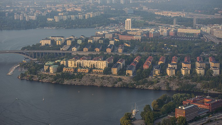
Tranebergs strand
Tranebergs strand is a residential area in Stockholm, Stockholm Municipality, Stockholm County. Tranebergs strand is situated nearby to the square Kalle Schröders Torg, as well as near the apartment building Alviks Torn.| Tap on a place to explore it |
- Type: Residential area
- Description: street and residential area in Traneberg, western Stockholm, Sweden
- Also known as: “Tranebergs Strand”
Places of Interest Nearby
Highlights include Tranebergsbron and Alvik metro station.
Tranebergsbron
Bridge

Photo: Holger.Ellgaard, CC BY-SA 3.0.
Tranebergsbron, also known as the Traneberg Bridge, is a double arch bridge located in central Stockholm, Sweden. Stretching over the strait Tranebergssund it connects the major island Kungsholmen with the western suburb Bromma. Tranebergsbron is situated 360 metres east of Tranebergs strand.
Alvik metro station
Metro station

Photo: Wikimedia, Copyrighted free use.
Alvik metro station is a station on the Green line of the Stockholm metro, and on the Tvärbanan and Nockebybanan lines of Stockholm tramways. It is located on the border between the districts of Traneberg and Alvik, which are part of the borough of Bromma in the west of the city of Stockholm. Alvik metro station is situated 400 metres west of Tranebergs strand.
Alvik Community Centre
Public building

Photo: Bysmon, CC BY-SA 3.0.
Alvik Community Centre is a public building, which is situated 580 metres west of Tranebergs strand.
Places in the Area
Nearby places include Alvik and Traneberg.
Alvik
Suburb

Photo: Kalle1, Public domain.
Alvik is a residential district in western Stockholm municipality and part of the Bromma borough.
Traneberg
Suburb

Photo: Holger.Ellgaard, CC BY-SA 3.0.
Traneberg is a residential district in western Stockholm and part of the Bromma borough. For the 1912 Summer Olympics, Tranebergs Idrottsplats hosted some of the football competitions. Most of the district was built between 1934 and 1940.
Tranebergs strand
- Category: street
- Location: Stockholm, Stockholms domkyrkoförs., Stockholm Municipality, Stockholm County, Svealand, Sweden, Nordic countries, Europe
- View on OpenStreetMap
Latitude
59.3324° or 59° 19′ 57″ northLongitude
17.98915° or 17° 59′ 21″ eastOpen location code
9FFV8XJQ+XMOpenStreetMap ID
way 119159610OpenStreetMap feature
landuse=residentialWikidata ID
Q10701260
This page is based on OpenStreetMap, Wikidata, and Wikimedia Commons.
We’d love your help improving our open data sources. Thank you for contributing.
Satellite Map
Discover Tranebergs strand from above in high-definition satellite imagery.
In Other Languages
From Dutch to Swedish—“Tranebergs strand” goes by many names.
- Dutch: “Tranebergs strand”
- Swedish: “Tranebergs strand, Stockholm”
- Swedish: “Tranebergs strand, Traneberg”
- Swedish: “Tranebergs strand”
Notable Places Nearby
Highlights include Kalle Schröders Torg and Alviks Torn.
Nearby Places
Explore places such as Tranebergsbron and Tranebergsstugan.
Stockholm County: Must-Visit Destinations
Delve into Stockholm, Södermalm, Södertälje, and Norrmalm.
Curious Residential Areas to Discover
Uncover intriguing residential areas from every corner of the globe.
About Mapcarta. Data © OpenStreetMap contributors and available under the Open Database License". Text is available under the CC BY-SA 4.0 license, except for photos, directions, and the map. Photo: Smiley.toerist, CC BY-SA 4.0.