Royal Marines Poole
Royal Marines Poole is a helipad in Bournemouth, Christchurch and Poole Council, England. Royal Marines Poole is situated nearby to the military installation MOD - WW2 Flying Boat Fuel Store, as well as near the security checkpoint Military Checkpoint.| Tap on a place to explore it |
Places of Interest Nearby
Highlights include Hamworthy railway station and Poole Museum.
Hamworthy railway station
Railway station

Photo: John Lamper, CC BY-SA 2.0.
Hamworthy railway station serves Hamworthy, an area of Poole in Dorset, England. It is a stop on the South West Main Line, located 115 miles 77 chains down the line from London Waterloo. Hamworthy railway station is situated 2,700 feet north of Royal Marines Poole.
Poole Museum
Museum
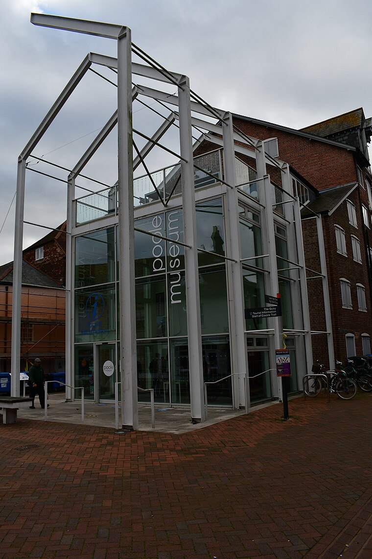 Poole Museum is a currently closed local history museum situated on the Lower High Street in the Old Town area of Poole, Dorset, and is part of the Borough of Poole Museum Service. Poole Museum is situated 1½ miles east of Royal Marines Poole.
Pergins Island
Island
Pergins Island is a small, uninhabited island in Holes Bay, an embayment off Poole Harbour in Dorset on the south coast of England. It is not accessible to the public.
Places in the Area
Nearby places include Hamworthy and Turlin Moor.
Hamworthy
Suburb

Photo: Mike Faherty, CC BY-SA 2.0.
Hamworthy is a suburb of Poole, in the Bournemouth, Christchurch and Poole district, in the ceremonial county of Dorset, England. It is sited on a peninsula of approximately 3 square kilometres that is bordered by the town of Upton to the north, Poole Harbour to the south, Lytchett Bay to the west and Holes Bay to the east.
Turlin Moor
Suburb
Turlin Moor is a suburb of Poole in Dorset, England, located between Hamworthy and Upton. Turlin Moor is host to Hamworthy railway station. The two railway bridges at the end of the estate on Blandford Road form the meeting point between Hamworthy, Turlin Moor and Upton Park.
Upton
Village

Photo: Mike Faherty, CC BY-SA 2.0.
Upton is a town in south-east Dorset, England. Upton is to the east of Holton Heath and Upton Heath, and to the north of the Poole suburb of Hamworthy. It is the second largest town in the Purbeck Hills. Upton is situated 1½ miles north of Royal Marines Poole.
Royal Marines Poole
- Type: Helipad
- Category: transportation
- Location: Bournemouth, Christchurch and Poole Council, England, United Kingdom, Britain and Ireland, Europe
- View on OpenStreetMap
Latitude
50.71825° or 50° 43′ 6″ northLongitude
-2.02289° or 2° 1′ 22″ westOpen location code
9C2VPX9G+7ROpenStreetMap ID
way 1218542765OpenStreetMap feature
aeroway=helipad
This page is based on OpenStreetMap, Wikidata, and Wikimedia Commons.
We’d love your help improving our open data sources. Thank you for contributing.
Satellite Map
Discover Royal Marines Poole from above in high-definition satellite imagery.
Places with the Same Name
Discover other places named “Royal Marines Poole”.
Notable Places Nearby
Highlights include Royal Marines Poole and MOD - WW2 Flying Boat Fuel Store.
Nearby Places
Explore places such as Napier Road Top and Rockley Marines Camp.
England: Must-Visit Destinations
Delve into London, Manchester, Sheffield, and Leeds.
Curious Helipads to Discover
Uncover intriguing helipads from every corner of the globe.
About Mapcarta. Data © OpenStreetMap contributors and available under the Open Database License". Text is available under the CC BY-SA 4.0 license, except for photos, directions, and the map. Photo: sidibousaid, CC BY 2.0.