Corte del santuario
Corte del santuario is a grassland in Madignano, Province of Cremona, Lombardy. Corte del santuario is situated nearby to the church Santuario della Beata Vergine del Marzale, as well as near the cemetery Cimitero di Ripalta Vecchia.| Tap on a place to explore it |
Places of Interest Nearby
Highlights include Santuario della Beata Vergine del Marzale and Chiesa di S. Imerio.
Santuario della Beata Vergine del Marzale
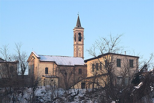
Church

Photo: Cremasco, CC BY-SA 2.5.
Santuario della Beata Vergine del Marzale is a church.
Chiesa di S. Imerio
Church

Photo: Cremasco, CC BY-SA 2.5.
Chiesa di S. Imerio is a church, which is situated 1¼ km northwest of Corte del santuario.
San Pietro in Vincoli
Church

Photo: Cremasco, CC BY-SA 2.5.
San Pietro in Vincoli is a church, which is situated 2 km northeast of Corte del santuario.
Places in the Area
Nearby places include Ripalta Vecchia and Ripalta Cremasca.

Madignano
Village
Photo: Cremasco, CC BY-SA 2.5.
Madignano is a comune in the Province of Cremona in the Italian region Lombardy, located about 45 kilometres southeast of Milan and about 35 kilometres northwest of Cremona.
Corte del santuario
- Type: Grassland
- Location: Madignano, Province of Cremona, Lombardy, Northwest Italy, Italy, Europe
- View on OpenStreetMap
Latitude
45.32693° or 45° 19′ 37″ northLongitude
9.71247° or 9° 42′ 45″ eastOpen location code
8FQF8PG6+QXOpenStreetMap ID
way 1224765526OpenStreetMap feature
landuse=grass
This page is based on OpenStreetMap, Wikidata, and Wikimedia Commons.
We’d love your help improving our open data sources. Thank you for contributing.
Satellite Map
Discover Corte del santuario from above in high-definition satellite imagery.
Notable Places Nearby
Highlights include Cimitero di Ripalta Vecchia and villa Bonzi.
Nearby Places
Explore places such as Famas carni and La Tana del Lupo.
Lombardy: Must-Visit Destinations
Delve into Milan, Bergamo, Brescia, and Mantua.
Curious Grasslands to Discover
Uncover intriguing grasslands from every corner of the globe.
About Mapcarta. Data © OpenStreetMap contributors and available under the Open Database License". Text is available under the CC BY-SA 4.0 license, except for photos, directions, and the map. Photo: Jakubhal, CC BY-SA 3.0.