Mezcal Squat
Mezcal Squat is a building in Collegno, Province of Turin, Piedmont. Mezcal Squat is situated nearby to the park Parco Generale Carlo Alberto Dalla Chiesa, as well as near Piazza della Pace.| Tap on a place to explore it |
Places of Interest Nearby
Highlights include Collegno railway station and San Massimo.
Collegno railway station
Railway station
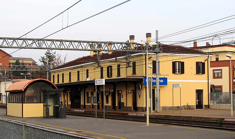
Photo: F Ceragioli, CC BY-SA 3.0.
Collegno is a railway station in Collegno. The station is located on the Turin–Modane railway. The train services are operated by Trenitalia. This station would serve as an interchange with the Turin Metro with the extension of Line 1 to Cascine Vica in 2023. Collegno railway station is situated 470 metres southwest of Mezcal Squat.
San Massimo
Church

Photo: AleMacStro, CC BY-SA 4.0.
San Massimo is a church, which is situated 1 km south of Mezcal Squat.
Turin-Aeritalia Airport
Aerodrome

Photo: Eio, CC BY-SA 3.0.
Turin-Aeritalia Airport also known as Edoardo Agnelli Airport, built in 1916, is the historical airport of Turin in the Piedmont region of northern Italy.
Places in the Area
Nearby places include Grugliasco and Leumann.
Grugliasco
Town

Photo: Touriste, Public domain.
Grugliasco is a comune in the Metropolitan City of Turin in the Italian region of Piedmont, about 9 kilometres west of Turin. Grugliasco borders the municipalities of Turin, Collegno, and Rivoli.

Cascine Vica
Suburb

Photo: Pmk58, CC BY-SA 4.0.
Cascine Vica is a suburb, which is situated 3 km west of Mezcal Squat.
Mezcal Squat
- Type: Building
- Location: Collegno, Province of Turin, Piedmont, Northwest Italy, Italy, Europe
- View on OpenStreetMap
Latitude
45.0811° or 45° 4′ 52″ northLongitude
7.57932° or 7° 34′ 46″ eastLevels
1Height
4 metres (13 feet)Open location code
8FQ93HJH+CPOpenStreetMap ID
way 122728258OpenStreetMap feature
building=yes
This page is based on OpenStreetMap, Wikidata, and Wikimedia Commons.
We’d love your help improving our open data sources. Thank you for contributing.
Satellite Map
Discover Mezcal Squat from above in high-definition satellite imagery.
Notable Places Nearby
Highlights include Parco Generale Carlo Alberto Dalla Chiesa and Piazza della Pace.
Nearby Places
Explore places such as Arco Rosso and Asylum Beestrot.
Piedmont: Must-Visit Destinations
Delve into Turin, Novara, Asti, and Alessandria.
Curious Buildings to Discover
Uncover intriguing buildings from every corner of the globe.
About Mapcarta. Data © OpenStreetMap contributors and available under the Open Database License". Text is available under the CC BY-SA 4.0 license, except for photos, directions, and the map. Photo: Toma15996, CC BY-SA 4.0.