ישיבת חסידי ברסלב
ישיבת חסידי ברסלב is a building in Israel. ישיבת חסידי ברסלב is situated nearby to the synagogue Toldos Avrohom Yitzchok, as well as near Toldos Aharon Yeshiva.| Tap on a place to explore it |
Places of Interest Nearby
Highlights include Church of the Holy Sepulchre and Damascus Gate.
Church of the Holy Sepulchre
Church
 The Church of the Holy Sepulchre, also known as the Church of the Resurrection, is a fourth-century church in the Christian Quarter of the Old City of Jerusalem. Church of the Holy Sepulchre is situated 1 km southeast of ישיבת חסידי ברסלב.
Damascus Gate
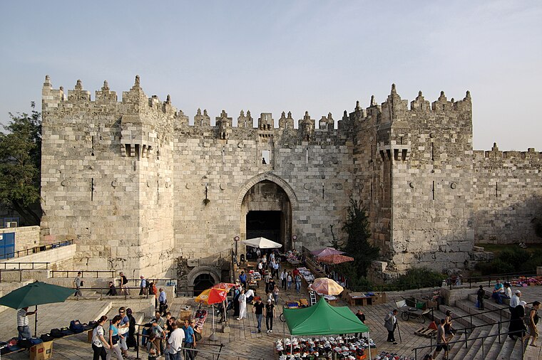
Photo: Berthold Werner, CC BY-SA 3.0.
The Damascus Gate is one of the main Gates of the Old City of Jerusalem. It is located in the wall on the city's northwest side and connects to a highway leading out to Nablus, which in the Hebrew Bible was called Shechem or Sichem, and from there, in times… Damascus Gate is situated 720 metres southeast of ישיבת חסידי ברסלב.
Toldos Avrohom Yitzchok
Synagogue
Toldos Avrohom Yitzchok is a Hasidic group located in Jerusalem's Mea Shearim neighborhood. It is an offshoot of the Hasidic group Toldos Aharon, which is in turn an offshoot of Shomer Emunim.
Places in the Area
Nearby places include Batei Ungarin and Meah Shearim.
Batei Ungarin
Neighborhood

Photo: Sir kiss, Public domain.
Batei Ungarin is a Haredi Jewish neighborhood in Jerusalem, north-east of the Old City of Jerusalem. It was built by Kolel Ungarin, a Hungarian Jewish charity supporting Jews living in the Land of Israel.
Meah Shearim
Suburb

Photo: Yoninah, CC BY-SA 3.0.
Mea Shearim is a neighborhood in West Jerusalem. It is one of the oldest Ashkenazi neighborhoods in Jerusalem outside of the Old City. It is populated by Ashkenazi Haredi Jews, and was built by members of the Old Yishuv.
Musrara
Suburb

Photo: Wikimedia, CC BY-SA 4.0.
Musrara is a formerly Ottoman neighborhood in what is now West Jerusalem. It is bordered by the Israeli neighborhoods of Mea Shearim and Beit Yisrael to the north, by the Russian Compound and Kikar Safra to the west, and by Mamilla mall to the south, and the Old City to the east.
ישיבת חסידי ברסלב
- Type: Building
- Location: Israel, Middle East, Asia
- View on OpenStreetMap
Latitude
31.7855° or 31° 47′ 8″ northLongitude
35.22421° or 35° 13′ 27″ eastOpen location code
8G3QQ6PF+5MOpenStreetMap ID
way 124097150OpenStreetMap feature
building=yes
This page is based on OpenStreetMap, Wikidata, and Wikimedia Commons.
We’d love your help improving our open data sources. Thank you for contributing.
Satellite Map
Discover ישיבת חסידי ברסלב from above in high-definition satellite imagery.
In Other Languages
“ישיבת חסידי ברסלב” goes by many names.
- Hebrew: “ישיבת חסידי ברסלב”
Notable Places Nearby
Highlights include Toldos Aharon Yeshiva and Lev Ram Building.
Nearby Places
Explore places such as בית מרקחת דויטש and מאוחדת - מאה שערים.
Israel: Must-Visit Destinations
Delve into Tel Aviv, Carmel Range, Haifa, and Nazareth.
Curious Buildings to Discover
Uncover intriguing buildings from every corner of the globe.
About Mapcarta. Data © OpenStreetMap contributors and available under the Open Database License". Text is available under the CC BY-SA 4.0 license, except for photos, directions, and the map. Photo: Bienchido, CC BY-SA 3.0.