Pack Horse Court
Pack Horse Court is an apartment building in Anstey, Charnwood District, England. Pack Horse Court is situated nearby to the recreation area Mitchell’s Field, as well as near the pitch Anstey Nomads FC.| Tap on a place to explore it |
Places of Interest Nearby
Highlights include King William’s Bridge and St Mary’s Church.
King William’s Bridge

Photo: Mat Fascione, CC BY-SA 2.0.
King William’s Bridge is situated 1,000 feet east of Pack Horse Court.
St Mary’s Church
Church

Photo: Michig, CC BY-SA 3.0.
St Mary's Church is the Church of England parish church in Anstey, Leicestershire, in the Diocese of Leicester. St Mary’s Church is situated 1,600 feet southwest of Pack Horse Court.
The Martin High School, Anstey
School
The Martin High School is a coeducational secondary school with academy status, located in the village of Anstey, Leicestershire, on the outskirts of Leicester. The Martin High School, Anstey is situated 2,500 feet northwest of Pack Horse Court.
Places in the Area
Nearby places include Cropston and Glenfield.
Cropston
Village
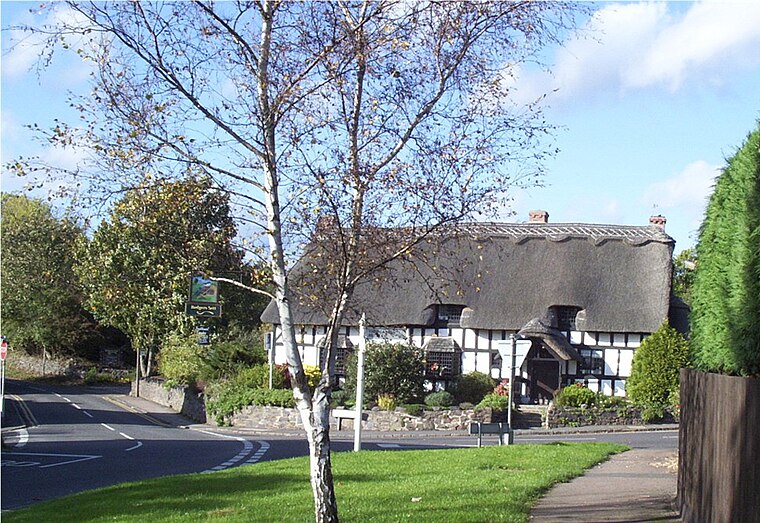
Photo: Kev747, Public domain.
Cropston is a village and former civil parish, now in the parish of Thurcaston and Cropston, part of the Borough of Charnwood in Leicestershire, England.
Glenfield
Village

Photo: Kev747, CC BY-SA 3.0.
Glenfield is a large village and former civil parish, now in the parish of Glenfields, in the Blaby district of Leicestershire, England. At the 2011 Census, Glenfields had a population of 9,643. Glenfield is situated 2 miles southwest of Pack Horse Court.
Newfoundpool
Suburb
Newfoundpool is an area of Leicester lying south of the former Leicester and Swannington Railway. The land was purchased by market gardener Isaac Harrison in around 1830. Newfoundpool is situated 2½ miles southeast of Pack Horse Court.
Pack Horse Court
- Type: Apartment building
- Categories: building and residential building
- Location: Anstey, Charnwood District, Leicestershire, East Midlands, England, United Kingdom, Britain and Ireland, Europe
- View on OpenStreetMap
Latitude
52.67454° or 52° 40′ 28″ northLongitude
-1.18301° or 1° 10′ 59″ westOpen location code
9C4WMRF8+RQOpenStreetMap ID
way 1288537970OpenStreetMap feature
building=apartments
This page is based on OpenStreetMap, Wikidata, and Wikimedia Commons.
We’d love your help improving our open data sources. Thank you for contributing.
Satellite Map
Discover Pack Horse Court from above in high-definition satellite imagery.
Places with the Same Name
Discover other places named “Pack Horse Court”.
Notable Places Nearby
Highlights include Mitchell’s Field and Anstey Nomads FC.
Nearby Places
Explore places such as The Signal Box and Sturgess Of Leicester.
Leicestershire: Must-Visit Destinations
Delve into Leicester, Loughborough, Hinckley, and Melton Mowbray.
Curious Apartment Buildings to Discover
Uncover intriguing apartment buildings from every corner of the globe.
About Mapcarta. Data © OpenStreetMap contributors and available under the Open Database License". Text is available under the CC BY-SA 4.0 license, except for photos, directions, and the map. Photo: Wikimedia, CC0.