Uniremington Corporación Universitaria
Uniremington Corporación Universitaria is an university building in La Candelaria, Medellín, Antioquia. Uniremington Corporación Universitaria is situated nearby to the community center Zonal ICBF, as well as near the square Berrío Park.| Tap on a place to explore it |
Places of Interest Nearby
Highlights include Berrío Park and Museum of Antioquia.
Berrío Park
Square

Photo: laloking97, CC BY-SA 2.0.
Berrío Park is an urban plaza located in the geographical heart of Medellín, Colombia. It is popular as a meeting place for local residents and as the main reference of the city for visitors, as there are several attractions nearby.
Museum of Antioquia
Museum

Photo: Carschten, CC BY-SA 4.0.
The Museum of Antioquia is an art museum in Medellín, Colombia. It houses a large collection of works by Medellín native Fernando Botero and Pedro Nel Gómez. Museum of Antioquia is situated 230 metres north of Uniremington Corporación Universitaria.
Teatro Lido
Theater building
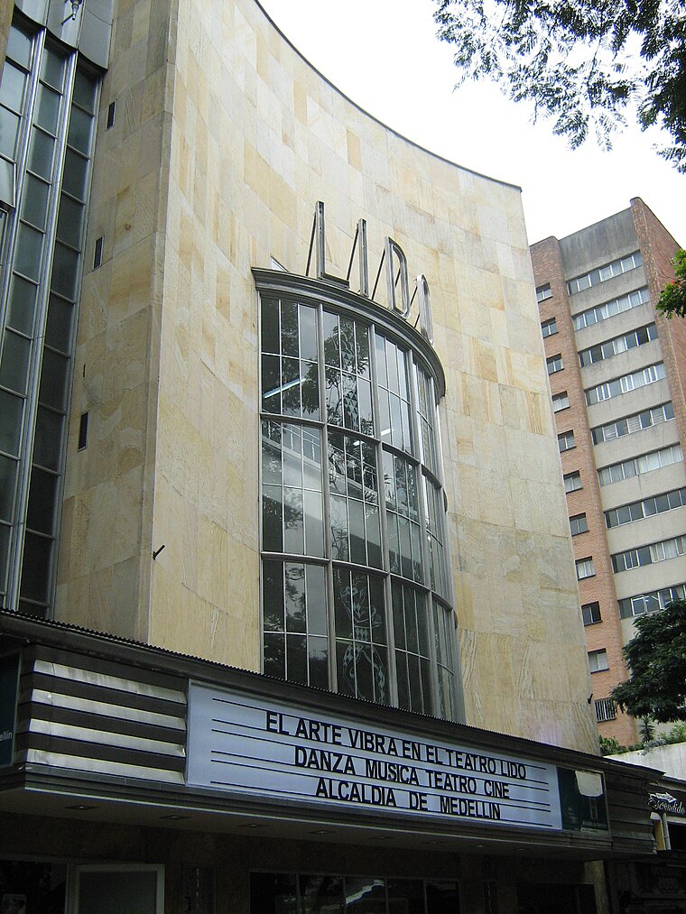
Photo: SajoR, CC BY-SA 3.0.
The Teatro Lido is a Colombian theater located at the southeastern coast of Park of Bolívar, in Medellín. The theater began operating in 1945 and in 2007, after a methodical restoration was reopened, and is administered by the Mayor of Medellin. Teatro Lido is situated 500 metres northeast of Uniremington Corporación Universitaria.
Places in the Area
Nearby places include Aranjuez and Robledo.
Aranjuez
Suburb

Photo: SajoR, Public domain.
Aranjuez is a suburb, which is situated 3 km north of Uniremington Corporación Universitaria.
Robledo
Suburb

Photo: SajoR, CC BY-SA 2.5.
Robledo is a suburb, which is situated 4 km northwest of Uniremington Corporación Universitaria.
Doce de Octubre
Suburb

Photo: Albeiror24, Public domain.
Doce de Octubre is a suburb, which is situated 5 km north of Uniremington Corporación Universitaria.
Uniremington Corporación Universitaria
- Type: University building
- Categories: building and education
- Location: La Candelaria, Medellín, Antioquia, Andino, Colombia, South America
- View on OpenStreetMap
Latitude
6.25041° or 6° 15′ 2″ northLongitude
-75.56854° or 75° 34′ 7″ westLevels
20Open location code
67R67C2J+5HOpenStreetMap ID
way 130447915OpenStreetMap feature
building=university
This page is based on OpenStreetMap, Wikidata, and Wikimedia Commons.
We’d love your help improving our open data sources. Thank you for contributing.
Satellite Map
Discover Uniremington Corporación Universitaria from above in high-definition satellite imagery.
Notable Places Nearby
Highlights include Zonal ICBF and La Media Naranja.
Nearby Places
Explore places such as Almacenes Navarro Ospina (electrodomésticos) and Electrodomésticos.
Antioquia: Must-Visit Destinations
Delve into Santa Fe de Antioquia, Guatape, Jardín, and Turbo.
Curious Places to Discover
Uncover intriguing places from every corner of the globe.
About Mapcarta. Data © OpenStreetMap contributors and available under the Open Database License". Text is available under the CC BY-SA 4.0 license, except for photos, directions, and the map. Photo: Dr EG, CC BY 2.0.