Camping Druivenland
Camping Druivenland is a campsite in Overijse, Arrondissement Halle-Vilvoorde, Flanders which is located on Nijvelsebaan. Camping Druivenland is situated nearby to the castle Ter Dect, as well as near the sports venue Atletiekpark Den Heurk.| Tap on a place to explore it |
- Email: info@campingdruivenland.be
- Type: Campsite
- Address: Nijvelsebaan 80
Places of Interest Nearby
Highlights include Begijnhofkapel and Saint Martin’s church.
Begijnhofkapel
Church
 Begijnhofkapel is a church, which is situated 1½ km northwest of Camping Druivenland.
Saint Martin’s church
Church

Photo: Wouterhagens, CC BY-SA 3.0.
Saint Martin’s church is situated 1½ km northwest of Camping Druivenland.
Sint-Bernarduskerk
Church

Photo: Wouterhagens, CC BY-SA 3.0.
Sint-Bernarduskerk is a church, which is situated 1½ km southeast of Camping Druivenland.
Places in the Area
Nearby places include Rosières and Ottenburg.
Rosières
Village

Photo: Djozewal, CC BY-SA 4.0.
Rosières is a village, which is situated 3 km south of Camping Druivenland.
Ottenburg
Village

Photo: Wouterhagens, Public domain.
Ottenburg is a village in the municipality of Huldenberg in the province of Flemish Brabant, Belgium, close to the language border. The prehistoric earthwork, a long barrow known as de Tomme, is located here, identified in 2021 by archaeologists as the oldest such monument known in the Low Countries. Ottenburg is situated 5 km east of Camping Druivenland.
Hoeilaart
Town
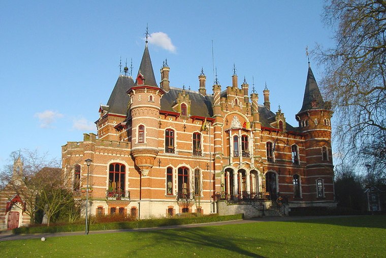
Photo: Wikimedia, CC BY-SA 3.0.
Hoeilaart is a municipality in the province of Flemish Brabant, Belgium. The name Hoeilaart is of Gallic-Celtic origin, coming from "Ho-Lar," meaning a high clearing in the woods. Hoeilaart is situated 5 km west of Camping Druivenland.
Camping Druivenland
- Categories: tourism and camping
- Location: Overijse, Arrondissement Halle-Vilvoorde, Flemish Brabant, Flanders, Belgium, Benelux, Europe
- View on OpenStreetMap
Latitude
50.7606° or 50° 45′ 38″ northLongitude
4.54861° or 4° 32′ 55″ eastOpen location code
9F26QG6X+6COpenStreetMap ID
way 1317128109OpenStreetMap feature
tourism=camp_site
This page is based on OpenStreetMap, Wikidata, and Wikimedia Commons.
We’d love your help improving our open data sources. Thank you for contributing.
Satellite Map
Discover Camping Druivenland from above in high-definition satellite imagery.
Notable Places Nearby
Highlights include Ter Dect and Atletiekpark Den Heurk.
Nearby Places
Explore places such as Vegemac and Overijse Nijvelsebaan.
Flemish Brabant: Must-Visit Destinations
Delve into Leuven, Kraainem, Vilvoorde, and Aarschot.
Curious Campsites to Discover
Uncover intriguing campsites from every corner of the globe.
About Mapcarta. Data © OpenStreetMap contributors and available under the Open Database License". Text is available under the CC BY-SA 4.0 license, except for photos, directions, and the map. Photo: Gf uip, CC BY-SA 3.0.