De Hagaard
De Hagaard is a community center in Flanders, Belgium which is located on Hagaard. De Hagaard is situated nearby to the town Overijse, as well as near Hoeilaart.| Tap on a place to explore it |
- Email: dehagaard@chirohuizen.be
- Type: Community center
- Address: Hagaard 45
Places of Interest Nearby
Highlights include Begijnhofkapel and Saint Martin’s church.

Saint Martin’s church
Church

Photo: Wouterhagens, CC BY-SA 3.0.
Saint Martin’s church is situated 1½ km northeast of De Hagaard.
Sint-Judocuskerk (Maleizen)
Church

Photo: Wouterhagens, Public domain.
Sint-Judocuskerk (Maleizen) is a church, which is situated 2 km south of De Hagaard.
Places in the Area
Nearby places include Overijse and Hoeilaart.
Overijse
Town

Photo: Wouterhagens, Public domain.
Overijse is a municipality in the province of Flemish Brabant, in the Flemish region of Belgium. It is a suburb of the wider Brussels metropolitan area.
Hoeilaart
Town
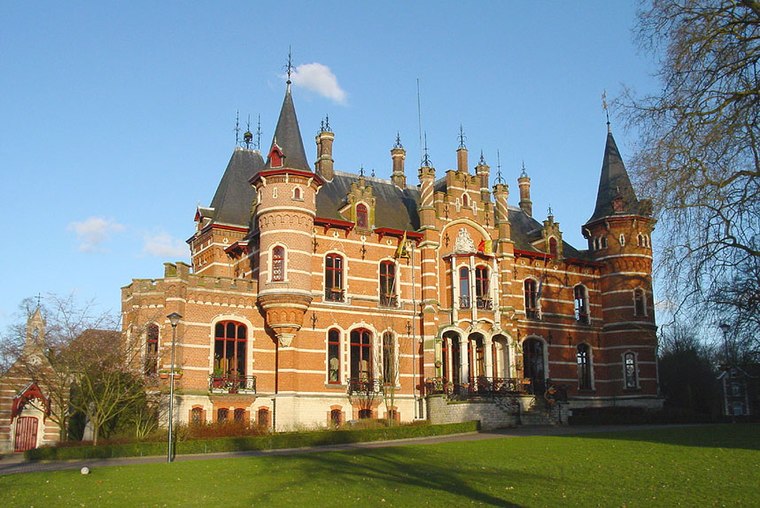
Photo: Wikimedia, CC BY-SA 3.0.
Hoeilaart is a municipality in the province of Flemish Brabant, Belgium. The name Hoeilaart is of Gallic-Celtic origin, coming from "Ho-Lar," meaning a high clearing in the woods. Hoeilaart is situated 3½ km west of De Hagaard.
Rosières
Village

Photo: Djozewal, CC BY-SA 4.0.
Rosières is a village, which is situated 4 km southeast of De Hagaard.
De Hagaard
Latitude
50.76477° or 50° 45′ 53″ northLongitude
4.52242° or 4° 31′ 21″ eastOperator
ChirohuizenOpen location code
9F26QG7C+WXOpenStreetMap ID
way 1317382500OpenStreetMap feature
amenity=community_centreOpenStreetMap feature
building=yes
This page is based on OpenStreetMap, Wikidata, and Wikimedia Commons.
We’d love your help improving our open data sources. Thank you for contributing.
Satellite Map
Discover De Hagaard from above in high-definition satellite imagery.
Places with the Same Name
Discover other places named “De Hagaard”.
Notable Places Nearby
Highlights include Hagaard and Sporthal Den Heurk.
Nearby Places
Explore places such as Rochuskapel and Overijse Hagaard.
Flanders: Must-Visit Destinations
Delve into Antwerp, Ghent, Bruges, and Sint-Truiden.
Curious Community Centers to Discover
Uncover intriguing community centers from every corner of the globe.
About Mapcarta. Data © OpenStreetMap contributors and available under the Open Database License". Text is available under the CC BY-SA 4.0 license, except for photos, directions, and the map. Photo: Gf uip, CC BY-SA 3.0.