Night Owl Brewery
Night Owl Brewery is a building in Cradley, Herefordshire, England which is located on Crumpton Hill. Night Owl Brewery is situated nearby to the community center Storridge Village Hall, as well as near the forest Rough Hill Wood.| Tap on a place to explore it |
- Email: info@nightowlbrewery.co.uk
- Type: Building
- Address: Crumpton Hill, Storridge, WR13 5HP
Places of Interest Nearby
Highlights include Church of St John the Evangelist and End Hill.
Church of St John the Evangelist
Church

Photo: Philip Halling, CC BY-SA 2.0.
Church of St John the Evangelist is situated 2,000 feet northwest of Night Owl Brewery.
End Hill
Peak

Photo: Derek Harper, CC BY-SA 2.0.
End Hill is the northernmost top of the Malvern Hills that runs approximately 13 kilometres north-south along the Herefordshire-Worcestershire border. It lies north of Table Hill and north-northwest of North Hill. It has an elevation of 329 metres.
Table Hill
Peak

Photo: Bob Embleton, CC BY-SA 2.0.
Table Hill is situated in the range of Malvern Hills that runs about 13 kilometres north-south along the Herefordshire-Worcestershire border. It lies between North Hill and Sugarloaf Hill and has an elevation of 373 metres.
Places in the Area
Nearby places include West Malvern and North Malvern.
West Malvern
Village
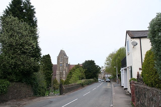
Photo: Bob Embleton, CC BY-SA 2.0.
West Malvern is a village and a civil parish on the west side of the north part of the Malvern Hills, on the western edge of Worcestershire, England. It has become effectively an outer suburb of Malvern and part of an urban area often called The Malverns, locally administered by Malvern Hills District Council and its own parish council.
North Malvern
Suburb
North Malvern is a suburb of Malvern, Worcestershire, England. It nestles on the northern slopes of the Malvern Hills. It is a contiguous urban extension of Link Top, and other neighbouring centres of population are Great Malvern, Malvern Link, West Malvern and the former village of Cowleigh.
Cradley
Village

Photo: Bob Embleton, CC BY-SA 2.0.
Cradley is a village in the civil parish of Cradley and Storridge, in Herefordshire, England. The nearest Herefordshire towns to Cradley are Ledbury, 9 miles to the south and Bromyard, 9 miles to the north-west.
Night Owl Brewery
Latitude
52.13332° or 52° 8′ northLongitude
-2.36057° or 2° 21′ 38″ westLevels
1Open location code
9C4V4JMQ+8QOpenStreetMap ID
way 1320444761OpenStreetMap feature
building=yes
This page is based on OpenStreetMap, Wikidata, and Wikimedia Commons.
We’d love your help improving our open data sources. Thank you for contributing.
Satellite Map
Discover Night Owl Brewery from above in high-definition satellite imagery.
Notable Places Nearby
Highlights include Storridge Village Hall and Rough Hill Wood.
Nearby Places
Explore places such as Brook House Farm and Lower Vinesend Farm.
Herefordshire: Must-Visit Destinations
Delve into Hereford, Leominster, Ross-on-Wye, and Ledbury.
Curious Buildings to Discover
Uncover intriguing buildings from every corner of the globe.
About Mapcarta. Data © OpenStreetMap contributors and available under the Open Database License". Text is available under the CC BY-SA 4.0 license, except for photos, directions, and the map. Photo: brianac37, CC BY 2.0.