Kay’s o‘ th’ Moss
Kay’s o‘ th’ Moss is a heath in Hyndburn District, Lancashire, England. Kay’s o‘ th’ Moss is situated nearby to Top o‘ th’ Moss (ruins), as well as near the heath Bentley Moss.| Tap on a place to explore it |
Places of Interest Nearby
Highlights include Calf Hey Reservoir and Helmshore Mills Textile Museum.
Calf Hey Reservoir
Reservoir

Photo: Thomas E Saunders, CC BY-SA 2.0.
Calf Hey Reservoir is a reservoir in Haslingden Grane, close to the town of Haslingden, in the Borough of Rossendale, England. It was the first of three reservoirs in the valley, the others being Ogden Reservoir and Holden Wood Reservoir.
Helmshore Mills Textile Museum
Museum

Photo: robert wade, CC BY-SA 2.0.
Helmshore Mills are two mills built on the River Ogden in Helmshore, Lancashire. Higher Mill was built in 1796 for William Turner, and Whitaker's Mill was built in the 1820s by the Turner family. Helmshore Mills Textile Museum is situated 2 miles east of Kay’s o‘ th’ Moss.
Old St Paul’s Church, Hoddlesden
Church
Old St Paul's Church is a former Anglican parish church in the village of Hoddlesden, Lancashire, England. The foundation stone was laid on 27 July 1861, and the church was consecrated in June 1863. Old St Paul’s Church, Hoddlesden is situated 2 miles west of Kay’s o‘ th’ Moss.
Places in the Area
Nearby places include Haslingden Grane and Hoddlesden.
Haslingden Grane
Hamlet
Haslingden Grane is the glaciated upper portion of the valley of the River Ogden, which lies west of Haslingden and is in the north east section of the West Pennine Moors.
Hoddlesden
Village
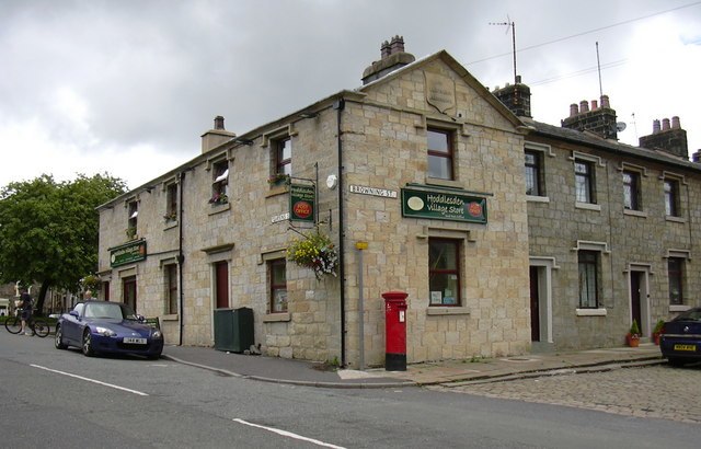
Photo: robert wade, CC BY-SA 2.0.
Hoddlesden is a village in the borough of Blackburn with Darwen, in Lancashire, England. The village population at the 2011 census was 1,239. It is in the borough's East Rural ward, and is situated east of Darwen. Hoddlesden is situated 2 miles west of Kay’s o‘ th’ Moss.
Haslingden
Town

Photo: Matthew Hartley, CC BY-SA 2.0.
Haslingden is a town in Rossendale, Lancashire, England. It is 16 miles north of Manchester. The name means 'valley of the hazels' or 'valley growing with hazels'. Haslingden is situated 2½ miles east of Kay’s o‘ th’ Moss.
Kay’s o‘ th’ Moss
- Type: Heath
- Location: Hyndburn District, Lancashire, North West England, England, United Kingdom, Britain and Ireland, Europe
- View on OpenStreetMap
Latitude
53.69039° or 53° 41′ 25″ northLongitude
-2.38779° or 2° 23′ 16″ westOpen location code
9C5VMJR6+5VOpenStreetMap ID
way 1345094401OpenStreetMap feature
natural=heath
This page is based on OpenStreetMap, Wikidata, and Wikimedia Commons.
We’d love your help improving our open data sources. Thank you for contributing.
Satellite Map
Discover Kay’s o‘ th’ Moss from above in high-definition satellite imagery.
Notable Places Nearby
Highlights include Top o‘ th’ Moss (ruins) and Bentley Moss.
Nearby Places
Explore places such as Whinberry Pasture and Pastures Higher Barn.
Lancashire: Must-Visit Destinations
Delve into Blackpool, Blackburn, Preston, and Lancaster.
Curious Heaths to Discover
Uncover intriguing heaths from every corner of the globe.
About Mapcarta. Data © OpenStreetMap contributors and available under the Open Database License". Text is available under the CC BY-SA 4.0 license, except for photos, directions, and the map. Photo: matthewhartley369, CC BY-SA 2.0.