Homeville Lodge
Homeville Lodge is a residential area in Brisbane, Queensland. Homeville Lodge is situated nearby to Brisbane North Oasis Church of Christ, as well as near the sports venue Sports Centre.| Tap on a place to explore it |
Places of Interest Nearby
Highlights include Mount Alvernia College and Lutwyche Cemetery.
Mount Alvernia College
College
Mount Alvernia College is an independent Roman Catholic secondary school for girls located in the Brisbane suburb of Kedron, in the state of Queensland, Australia. Mount Alvernia College is situated 550 metres northwest of Homeville Lodge.
Lutwyche Cemetery
Cemetery

Photo: Rocketrod1960, CC BY-SA 3.0.
Lutwyche Cemetery is a cemetery located at Kedron, Brisbane, Queensland, Australia. It opened in 1878 and saw its first burial in the same year. It is located at the corner of Gympie and Kitchener Roads, approximately ten kilometres north of Brisbane. Lutwyche Cemetery is situated 1 km north of Homeville Lodge.
Wooloowin State School
School

Photo: Shiftchange, CC0.
Wooloowin State School is a heritage-listed public co–educational primary school at 663 Lutwyche Road, Wooloowin, City of Brisbane, Queensland, Australia. It was built from 1914 to 1934. It was added to the Queensland Heritage Register on 13 January 1995. Wooloowin State School is situated 1 km southeast of Homeville Lodge.
Places in the Area
Nearby places include Kedron and Wooloowin.
Kedron
Suburb
Kedron is a northern suburb in the City of Brisbane, Queensland, Australia. It is home to the Queensland Fire and Emergency Services headquarters. In the 2021 census, Kedron had a population of 9,907 people.
Wooloowin
Suburb
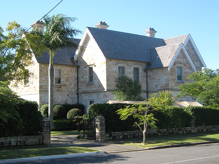
Photo: Gmcgarry, Public domain.
Wooloowin is a suburb in the City of Brisbane, Queensland, Australia. In the 2021 census, Wooloowin had a population of 4,029 people.
Kalinga
Suburb
Kalinga is a suburb in the City of Brisbane, Queensland, Australia. In the 2016 census, Kalinga had a population of 2,126 people.
Homeville Lodge
- Type: Residential area
- Location: Brisbane, Queensland, Australia, Oceania
- View on OpenStreetMap
Latitude
-27.41056° or 27° 24′ 38″ southLongitude
153.03024° or 153° 1′ 49″ eastOpen location code
5R4MH2QJ+Q3OpenStreetMap ID
way 1365886515OpenStreetMap feature
landuse=residential
This page is based on OpenStreetMap, Wikidata, and Wikimedia Commons.
We’d love your help improving our open data sources. Thank you for contributing.
Satellite Map
Discover Homeville Lodge from above in high-definition satellite imagery.
Notable Places Nearby
Highlights include Brisbane North Oasis Church of Christ and Sports Centre.
Nearby Places
Explore places such as Arch Court and Brook Court.
Queensland: Must-Visit Destinations
Delve into Brisbane, Gold Coast, Sunshine Coast, and Cairns.
Curious Residential Areas to Discover
Uncover intriguing residential areas from every corner of the globe.
About Mapcarta. Data © OpenStreetMap contributors and available under the Open Database License". Text is available under the CC BY-SA 4.0 license, except for photos, directions, and the map. Photo: Wikimedia, CC0.