Plazuela de Las Aguas
Plazuela de Las Aguas is a square in Candelaria, Bogotá D.C., Bogotá. Plazuela de Las Aguas is situated nearby to the marketplace Mercado de pulgas, as well as near the public building Instituto Colombiano de Crédito y Estudios Técnicos en el Exterior.| Tap on a place to explore it |
Places of Interest Nearby
Highlights include Gold Museum and Las Aguas.
Gold Museum
Museum
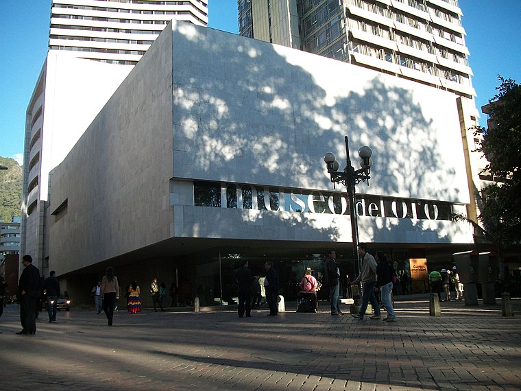
Photo: Pedro Felipe, CC BY-SA 3.0.
The Museum of Gold is an archaeology museum located in Bogotá, Colombia. It is one of the most visited touristic highlights in the country. The museum receives around 500,000 tourists per year. Gold Museum is situated 400 metres west of Plazuela de Las Aguas.
Las Aguas
Bus station

Photo: Pedro Felipe, CC BY-SA 3.0.
Las Aguas is a station on the TransMilenio mass-transit system of Bogotá, Colombia.
Iglesia de Nuestra Señora de las Aguas
Church

Photo: Baiji, CC BY-SA 4.0.
Iglesia de Nuestra Señora de las Aguas is a church, which is situated 180 metres east of Plazuela de Las Aguas.
Places in the Area
Nearby places include La Candelaria and Santa Fe.
La Candelaria
 La Candelaria is the historic center of Bogotá, and the city's principal destination for tourists. Home to the top museums, the government palaces, and beautiful old colonial buildings along narrow cobblestone streets, it's a must see.
Santa Fe
Suburb

Photo: Baiji, CC BY-SA 3.0.
Santa Fe is the third locality of Bogotá, the Capital District of Colombia. Santa Fe is part of the traditional downtown area where Bogotá was founded by Gonzalo Jiménez de Quesada on August 6, 1538.
Plazuela de Las Aguas
- Type: Square
- Category: locality
- Location: Candelaria, Bogotá D.C., Bogotá, Andino, Colombia, South America
- View on OpenStreetMap
Latitude
4.6019° or 4° 36′ 7″ northLongitude
-74.06827° or 74° 4′ 6″ westOpen location code
67P7JW2J+QMOpenStreetMap ID
way 1396103627OpenStreetMap feature
place=square
This page is based on OpenStreetMap, Wikidata, and Wikimedia Commons.
We’d love your help improving our open data sources. Thank you for contributing.
Satellite Map
Discover Plazuela de Las Aguas from above in high-definition satellite imagery.
Notable Places Nearby
Highlights include Mercado de pulgas and Instituto Colombiano de Crédito y Estudios Técnicos en el Exterior.
Nearby Places
Explore places such as Gabriel Betancourt and Academia Colombiana de la Lengua.
Bogotá: Must-Visit Destinations
Delve into La Candelaria, Zona Rosa, Santa Fé-Los Mártires, and Usaquén.
Curious Squares to Discover
Uncover intriguing squares from every corner of the globe.
About Mapcarta. Data © OpenStreetMap contributors and available under the Open Database License". Text is available under the CC BY-SA 4.0 license, except for photos, directions, and the map. Photo: Wikimedia, CC BY-SA 3.0.