בי’ס יסודי יצחק נבון
בי’ס יסודי יצחק נבון is a school in Tel Aviv, Israel. בי’ס יסודי יצחק נבון is situated nearby to the archaeological site גת משוכללת, as well as near Mulabbis.| Tap on a place to explore it |
Places of Interest Nearby
Highlights include Mulabbis and HaMoshava Stadium.
Mulabbis
Archaeological site
Tel Mulabbis is an archaeological mound in modern Petah Tikva, Israel. Mulabbis is a key site in the Yarkon River basin, with habitation remains from the Roman, Byzantine, Early Islamic, Crusader, Mamluk and Late Ottoman periods. Mulabbis is situated 300 metres east of בי’ס יסודי יצחק נבון.
HaMoshava Stadium
Stadium

Photo: Ptcom, CC BY-SA 4.0.
The HaMoshava Stadium, also known as Petah Tikva Stadium, is a football stadium in Petah Tikva, Israel completed in 2011. It is used mainly for football matches and is home to both Hapoel Petah Tikva and Maccabi Petah Tikva. HaMoshava Stadium is situated 1¼ km northwest of בי’ס יסודי יצחק נבון.
Rabin Medical Center – Beilinson Campus
Hospital
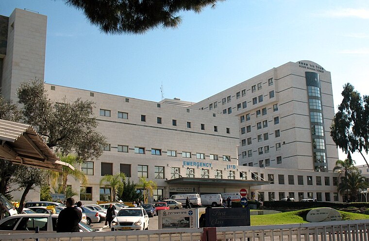
Photo: Wikimedia, Public domain.
Rabin Medical Center is a large general hospital located in Petah Tikva, Israel. It is owned and operated by Clalit Health Services, Israel's largest health maintenance organization. Rabin Medical Center – Beilinson Campus is situated 1½ km southwest of בי’ס יסודי יצחק נבון.
Places in the Area
Nearby places include Ramat Verber and Petah Tikva.

Petah Tikva

Photo: Ynhockey, CC BY-SA 4.0.
Petah Tikva is an eastern suburb of Tel Aviv, Israel, population 248,000. For those into early Zionist history, a number of the old buildings have been preserved, though they can be hard to find, and the signs describing them are only in Hebrew.
Ein Ganim
Suburb

Photo: Avi1111, CC BY-SA 2.5.
Ein Ganim was the first moshav po'alim in Israel. The moshav was established in 1908 near Petah Tikva by members of the Second Aliyah and was named after the Levitical city of Ein Ganim, mentioned in the book of Joshua 21:29.
בי’ס יסודי יצחק נבון
- Type: School
- Category: education
- Location: Tel Aviv, Israel, Middle East, Asia
- View on OpenStreetMap
Latitude
32.09991° or 32° 5′ 60″ northLongitude
34.877° or 34° 52′ 37″ eastOpen location code
8G4P3VXG+XQOpenStreetMap ID
way 1416951233OpenStreetMap feature
amenity=school
This page is based on OpenStreetMap, Wikidata, and Wikimedia Commons.
We’d love your help improving our open data sources. Thank you for contributing.
Satellite Map
Discover בי’ס יסודי יצחק נבון from above in high-definition satellite imagery.
Notable Places Nearby
Highlights include גת משוכללת and פארק לב הסביונים.
Nearby Places
Explore places such as גן עופרים and Em HaMoshavot Mall/Rishon LeTsiyon.
Israel: Must-Visit Destinations
Delve into Tel Aviv, Haifa, Nazareth, and Carmel Range.
Curious Schools to Discover
Uncover intriguing schools from every corner of the globe.
About Mapcarta. Data © OpenStreetMap contributors and available under the Open Database License". Text is available under the CC BY-SA 4.0 license, except for photos, directions, and the map. Photo: Bienchido, CC BY-SA 3.0.