École Jean Jaurès
École Jean Jaurès is a school building in Esch-sur-Alzette, Luxembourg. École Jean Jaurès is situated nearby to the bridge Viaduc, as well as near the square Place de Stalingrad.| Tap on a place to explore it |
Places of Interest Nearby
Highlights include National Resistance Museum, Luxembourg and Théâtre d’Esch.
National Resistance Museum, Luxembourg
Museum

Photo: Cayambe, CC BY-SA 4.0.
The National Museum of Resistance and Human Rights is located in the centre of Esch-sur-Alzette in the south-west of Luxembourg. The specially designed building traces the history of Luxembourg from 1940 to 1945 under the Nazi oppression, through the reactions of the people, until liberation, by photos, objects and works of art. National Resistance Museum, Luxembourg is situated 640 metres southeast of École Jean Jaurès.
Théâtre d’Esch
Theater building

Photo: MMFE, CC BY-SA 4.0.
Théâtre d’Esch is a theatre in Esch-sur-Alzette, Luxembourg. Directed by Carole Lorang, the main auditorium has 517 numbered seats. The theatre puts on performances of operas, operettas, concerts, dance performances, variety, jazz, songs, musicals and other entertainment. Théâtre d’Esch is situated 670 metres southeast of École Jean Jaurès.
Saint Henri Church of Esch-sur-Alzette
Church
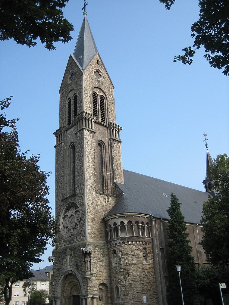
Photo: Zinneke, CC BY-SA 3.0.
Saint Henri Church of Esch-sur-Alzette is situated 420 metres northeast of École Jean Jaurès.
Places in the Area
Nearby places include Esch-sur-Alzette and Land of the Red Rocks.
Esch-sur-Alzette
Town

Photo: Zinneke, CC BY-SA 4.0.
The Land of the Red Rocks, also known as the Esch-sur-Alzette canton, is the southwestmost region of Luxembourg.
Land of the Red Rocks
The Land of the Red Rocks, also known as the Esch-sur-Alzette canton, is the southwestmost region of Luxembourg.Russange
Village

Photo: Aimelaime, Public domain.
Russange is a commune in the Moselle department in Grand Est in north-eastern France.
École Jean Jaurès
- Type: School building
- Categories: building and education
- Location: Esch-sur-Alzette, Luxembourg, Benelux, Europe
- View on OpenStreetMap
Latitude
49.49752° or 49° 29′ 51″ northLongitude
5.97193° or 5° 58′ 19″ eastOpen location code
8FX7FXXC+2QOpenStreetMap ID
way 1446954395OpenStreetMap feature
building=school
This page is based on OpenStreetMap, Wikidata, and Wikimedia Commons.
We’d love your help improving our open data sources. Thank you for contributing.
Satellite Map
Discover École Jean Jaurès from above in high-definition satellite imagery.
Notable Places Nearby
Highlights include Viaduc and Place de Stalingrad.
Nearby Places
Explore places such as École Jean Jaurès and Esch/Alzette, Auszeibreck.
Luxembourg: Must-Visit Destinations
Delve into Luxembourg, Central Luxembourg, Schengen, and Echternach.
Curious Schools to Discover
Uncover intriguing schools from every corner of the globe.
About Mapcarta. Data © OpenStreetMap contributors and available under the Open Database License". Text is available under the CC BY-SA 4.0 license, except for photos, directions, and the map. Photo: Michal Osmenda, CC BY-SA 2.0.