parking Yoga
parking Yoga is a parking area in Castellamonte, Province of Turin, Piedmont. parking Yoga is situated nearby to the grassland Landing Paragliding Tenuto Boschetto, as well as near the dwelling Canton Belvedere.| Tap on a place to explore it |
Places of Interest Nearby
Highlights include Cuorgnè train station and Museo archeologico del Canavese.
Cuorgnè train station
Railway station
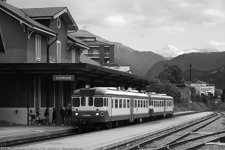
Photo: Wikimedia, CC BY-SA 3.0.
Cuorgnè train station is a railway station, which is situated 1½ km west of parking Yoga.
Museo archeologico del Canavese
Museum

Photo: Laurom, CC BY-SA 2.5.
Museo archeologico del Canavese is a museum, which is situated 1½ km west of parking Yoga.
Valperga railway halt
Railway station

Photo: Wikimedia, CC BY-SA 3.0.
Valperga railway halt is a railway station, which is situated 2½ km southwest of parking Yoga.
Places in the Area
Nearby places include Pianezze and Priacco.


Ronchi San Bernardo
Hamlet

Photo: Mamertino81, CC BY-SA 4.0.
Ronchi San Bernardo is a hamlet, which is situated 3 km west of parking Yoga.
parking Yoga
- Type: Parking area
- Category: transportation
- Location: Castellamonte, Province of Turin, Piedmont, Northwest Italy, Italy, Europe
- View on OpenStreetMap
Latitude
45.39111° or 45° 23′ 28″ northLongitude
7.67563° or 7° 40′ 32″ eastOpen location code
8FQ99MRG+C7OpenStreetMap ID
way 1447663916OpenStreetMap feature
amenity=parking
This page is based on OpenStreetMap, Wikidata, and Wikimedia Commons.
We’d love your help improving our open data sources. Thank you for contributing.
Satellite Map
Discover parking Yoga from above in high-definition satellite imagery.
Notable Places Nearby
Highlights include Landing Paragliding Tenuto Boschetto and Canton Belvedere.
Nearby Places
Explore places such as Tenuta Boschetto and Belvedere.
Piedmont: Must-Visit Destinations
Delve into Turin, Novara, Asti, and Alessandria.
Curious Parking Areas to Discover
Uncover intriguing parking areas from every corner of the globe.
About Mapcarta. Data © OpenStreetMap contributors and available under the Open Database License". Text is available under the CC BY-SA 4.0 license, except for photos, directions, and the map. Photo: Toma15996, CC BY-SA 4.0.