Fischer’s Weid
Fischer’s Weid is a nature reserve in Texel, North Holland. Fischer’s Weid is situated nearby to the village De Koog, as well as near the locality Paal 21.| Tap on a place to explore it |
Places of Interest
Highlights include Ecomare and Waalenburg.
Ecomare
Zoo
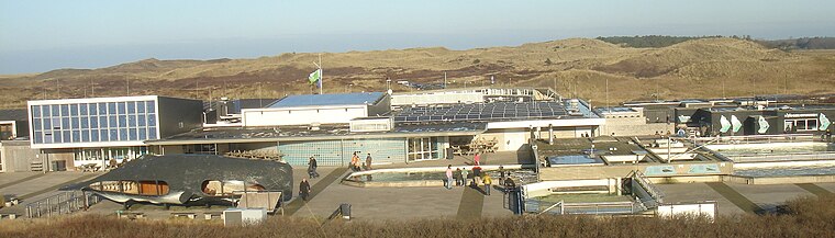
Photo: Traitor, CC BY-SA 3.0.
Duinen van Texel National Park is a national park located on the North Holland island of Texel in the Netherlands. All dune systems on the western side of the island and the large coastal plains on both the northern and southern points of the island are part of the park.


Places in the Area
Nearby places include Den Burg and De Koog.
Den Burg
Town

Photo: Paul van de Velde, CC BY 2.0.
Den Burg is a town in the Dutch province of North Holland. It is a part of the municipality of Texel on the island of the same name, and lies about 12 km north of Den Helder.
De Koog
Village
 De Koog is a village in the Dutch province of North Holland. It is a part of the municipality of Texel, and lies about 17 km north of Den Helder. It is the chief centre of tourism on the island, surrounded with many hotels and campgrounds.
De Waal
Village
De Waal is a village in the Dutch province of North Holland. It is a part of the municipality of Texel, and lies about 15 km north of Den Helder. The village was first mentioned in 1295 as "sancti Bonifacii in Waelkerken", and means "pond created after a dike breach".
Fischer’s Weid
- Type: Nature reserve
- Category: recreation area
- Location: Texel, North Holland, Western Netherlands, Netherlands, Benelux, Europe
- View on OpenStreetMap
Latitude
53.0963° or 53° 5′ 47″ northLongitude
4.7739° or 4° 46′ 26″ eastOperator
Landschap Noord-HollandOpen location code
9F563QWF+GGOpenStreetMap ID
way 1465142313OpenStreetMap feature
leisure=nature_reserve
This page is based on OpenStreetMap, Wikidata, and Wikimedia Commons.
We’d love your help improving our open data sources. Thank you for contributing.
Satellite Map
Discover Fischer’s Weid from above in high-definition satellite imagery.
Localities in the Area
Explore places such as Paal 21 and Paal 19.
Notable Places Nearby
Highlights include Speelweide and Spielpark Bregkoog.
North Holland: Must-Visit Destinations
Delve into Amsterdam, Haarlem, Alkmaar, and Schiphol Airport.
Curious Nature Reserves to Discover
Uncover intriguing nature reserves from every corner of the globe.
About Mapcarta. Data © OpenStreetMap contributors and available under the Open Database License". Text is available under the CC BY-SA 4.0 license, except for photos, directions, and the map. Photo: Jerreantwerp, Public domain.