Wheel Bank Coppice
Wheel Bank Coppice is a forest in Torver, Westmorland and Furness, England. Wheel Bank Coppice is situated nearby to the locality Brocklebank Ground, as well as near Under Crag.| Tap on a place to explore it |
Places of Interest
Highlights include St Luke’s Church, Torver and Peel Island.
St Luke’s Church, Torver
Church

Photo: Wikimedia, CC BY-SA 2.0.
St Luke's Church is in the village of Torver, Cumbria, England. It is an active Anglican parish church in the deanery of Furness, the archdeaconry of Westmorland and Furness, and the diocese of Carlisle.
Peel Island
Island
Peel Island is one of the three islands of Coniston Water in the English Lake District, Cumbria. The two others are Fir Island and Oak Island. It is most famous for being one of the inspirations for Arthur Ransome's Wild Cat Island.
Brown Pike
Peak

Photo: Ian Greig, CC BY-SA 2.0.
Brown Pike is a fell located in the Lake District National Park in Cumbria, England. Brown Pike is near the village of Coniston, and is most commonly approached from there with walkers often continuing onto Buck Pike, Dow Crag and the Old Man of Coniston.
Places in the Area
Nearby places include Coniston and Seathwaite.
Coniston

Photo: Tompage02, Public domain.
Coniston is a picturesque lakeside village in the Lake District National Park. Coniston sits next to Coniston Water, the Lake District's third largest lake is the home to many attempts at the world water speed record.
Seathwaite
Village
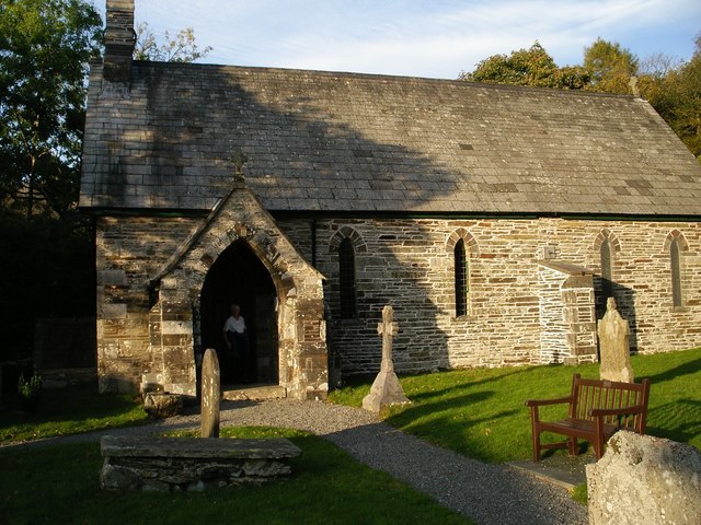
Photo: Gordon Mellor, CC BY-SA 2.0.
Seathwaite is a village in the Dunnerdale-with-Seathwaite civil parish in the Westmorland and Furness district of Cumbria in North West England. It is in the Lake District and part of historic Lancashire.
Nibthwaite
Village

Photo: Peter Bond, CC BY-SA 2.0.
Nibthwaite is a village in the Westmorland and Furness district, in the county of Cumbria in the northwest of England. It is in the civil parish of Colton, and on the east side of Coniston Water.
Wheel Bank Coppice
Latitude
54.3365° or 54° 20′ 12″ northLongitude
-3.1146° or 3° 6′ 53″ westOpen location code
9C6R8VPP+J4OpenStreetMap ID
way 156525861OpenStreetMap feature
landuse=forest
This page is based on OpenStreetMap, Wikidata, and Wikimedia Commons.
We’d love your help improving our open data sources. Thank you for contributing.
Satellite Map
Discover Wheel Bank Coppice from above in high-definition satellite imagery.
Localities in the Area
Explore places such as Brocklebank Ground and Under Crag.
Notable Places Nearby
Highlights include Low Wood and Middle Coppice.
Cumbria: Must-Visit Destinations
Delve into Carlisle, Barrow-in-Furness, Kendal, and Penrith.
Curious Forests to Discover
Uncover intriguing forests from every corner of the globe.
About Mapcarta. Data © OpenStreetMap contributors and available under the Open Database License". Text is available under the CC BY-SA 4.0 license, except for photos, directions, and the map. Photo: ramsd, CC BY 2.0.