Vrije Middenschool Zonhoven
Vrije Middenschool Zonhoven is a school building in Zonhoven, Hasselt, Flanders which is located on Engstegenseweg. Vrije Middenschool Zonhoven is situated nearby to the house De Franse Kroon, Zonhoven, as well as near the town hall Gemeentehuis Zonhoven.| Tap on a place to explore it |
Places of Interest Nearby
Highlights include Oud-gemeentehuis van Zonhoven and Sint-Quintinuskerk.
Oud-gemeentehuis van Zonhoven
Historic building

Photo: Sonuwe, CC BY-SA 3.0.
Oud-gemeentehuis van Zonhoven is a historic building, which is situated 350 metres southeast of Vrije Middenschool Zonhoven.
Sint-Quintinuskerk
Church

Photo: Sonuwe, CC BY-SA 3.0.
Sint-Quintinuskerk is a church, which is situated 330 metres southeast of Vrije Middenschool Zonhoven.
De Franse Kroon, Zonhoven
House

Photo: Sonuwe, CC BY-SA 3.0.
De Franse Kroon, Zonhoven is a house, which is situated 270 metres northeast of Vrije Middenschool Zonhoven.
Places in the Area
Nearby places include Zonhoven and Kiewit.
Zonhoven
Town

Photo: Paul Hermans, CC BY-SA 3.0.
Zonhoven is a municipality located in the middle of the Belgian province of Limburg located north of Hasselt and also borders Houthalen-Helechteren, Genk and Heusden-Zolder.
Kiewit
Hamlet

Photo: Sonuwe, CC BY-SA 3.0.
Kiewit is a Belgian parish and village within the northernmost extension of the Flemish municipality of Hasselt. It also borders on the municipality of Zonhoven to the north and Genk to the east, with Kuringen, another part of Hasselt, to the west. Kiewit is situated 3½ km south of Vrije Middenschool Zonhoven.
Houthalen
Village
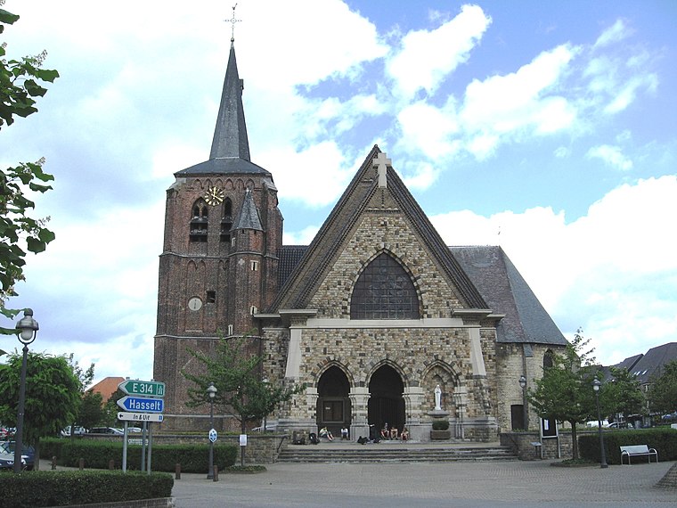
Photo: Sonuwe, CC BY-SA 3.0.
Houthalen is a village, which is situated 4 km north of Vrije Middenschool Zonhoven.
Vrije Middenschool Zonhoven
Latitude
50.99356° or 50° 59′ 37″ northLongitude
5.36469° or 5° 21′ 53″ eastOpen location code
9F27X9V7+CVOpenStreetMap ID
way 171818327OpenStreetMap feature
building=school
This page is based on OpenStreetMap, Wikidata, and Wikimedia Commons.
We’d love your help improving our open data sources. Thank you for contributing.
Satellite Map
Discover Vrije Middenschool Zonhoven from above in high-definition satellite imagery.
Notable Places Nearby
Highlights include Gemeentehuis Zonhoven and Basket Zonhoven.
Nearby Places
Explore places such as VMS Zonhoven and Het Pand.
Limburg: Must-Visit Destinations
Delve into Sint-Truiden, Tongeren, Genk, and Maasmechelen.
Curious Schools to Discover
Uncover intriguing schools from every corner of the globe.
About Mapcarta. Data © OpenStreetMap contributors and available under the Open Database License". Text is available under the CC BY-SA 4.0 license, except for photos, directions, and the map. Photo: Jeanhousen, CC BY 3.0.