Klootshof
Klootshof is a building in Limburg, Flanders which is located on Clootsweg. Klootshof is situated nearby to the chapel-shrine Mariabeeld, as well as near the amusement arcade Farmfun Bocholt.| Tap on a place to explore it |
Places of Interest Nearby
Highlights include Clootsmolen and Voorste Luysmolen.

Voorste Luysmolen
Tourism office

Photo: Eebie, CC BY-SA 4.0.
Voorste Luysmolen is a tourism office, which is situated 1½ km southeast of Klootshof.
St. Lawrence’s Church, Bocholt
Church
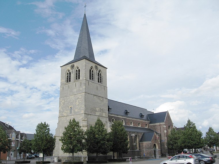
Photo: Sonuwe, CC BY-SA 3.0.
St. Lawrence's Church is the parish church of Bocholt, Belgium, dedicated to Saint Lawrence. St. Lawrence’s Church, Bocholt is situated 2½ km southwest of Klootshof.
Places in the Area
Nearby places include Bocholt and Beek.
Bocholt
Town
Photo: Sonuwe, CC BY-SA 3.0.
Bocholt is a municipality located in the Belgian province of Limburg. Bocholt is situated 2½ km southwest of Klootshof.
Beek
Village
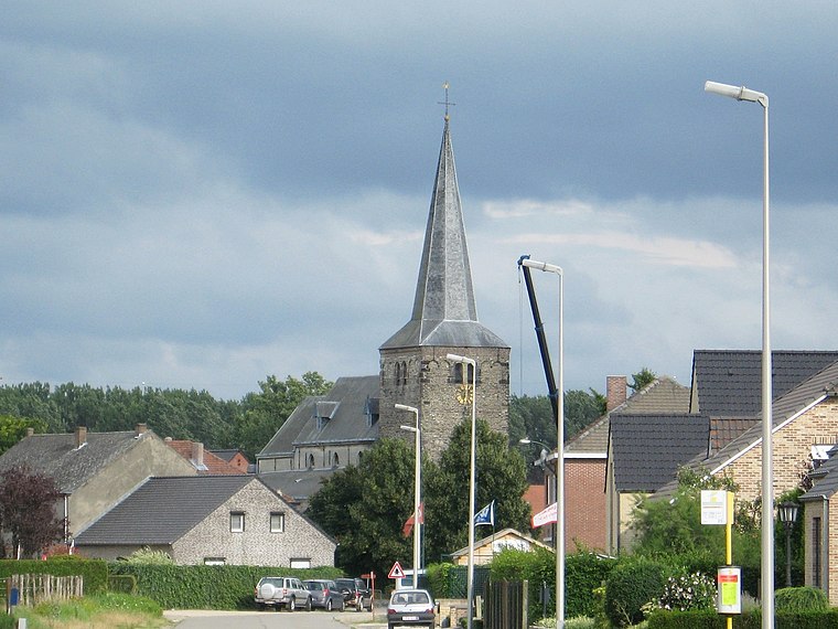
Photo: Sonuwe, CC BY-SA 3.0.
Beek is a village, which is situated 3½ km south of Klootshof.
Reppel
Village

Photo: Sonuwe, CC BY-SA 3.0.
Reppel is a village, which is situated 5 km southwest of Klootshof.
Klootshof
Latitude
51.18728° or 51° 11′ 14″ northLongitude
5.60976° or 5° 36′ 35″ eastOpen location code
9F375JP5+WWOpenStreetMap ID
way 199382671OpenStreetMap feature
building=yes
This page is based on OpenStreetMap, Wikidata, and Wikimedia Commons.
We’d love your help improving our open data sources. Thank you for contributing.
Satellite Map
Discover Klootshof from above in high-definition satellite imagery.
Notable Places Nearby
Highlights include Mariabeeld and Farmfun Bocholt.
Nearby Places
Explore places such as Bocholt Paulsenstraat and Vrije Basisschool De Driehoek.
Limburg: Must-Visit Destinations
Delve into Sint-Truiden, Hasselt, Tongeren, and Genk.
Curious Buildings to Discover
Uncover intriguing buildings from every corner of the globe.
About Mapcarta. Data © OpenStreetMap contributors and available under the Open Database License". Text is available under the CC BY-SA 4.0 license, except for photos, directions, and the map. Photo: Paul Hermans, CC BY-SA 3.0.