Sporting Grote-Brogel
Sporting Grote-Brogel is a pitch in Peer, Arrondissement of Maaseik, Flanders. Sporting Grote-Brogel is situated nearby to the chapel Kapel en Heilig Hartbeeld, as well as near the quarry Zandgroeve Winters.| Tap on a place to explore it |
Places of Interest Nearby
Highlights include Sint-Trudokerk and Kleine Brogel Air Base.
Sint-Trudokerk
Church

Photo: Sonuwe, CC BY-SA 3.0.
Sint-Trudokerk is a church, which is situated 1 km southwest of Sporting Grote-Brogel.
Kleine Brogel Air Base
Aerodrome
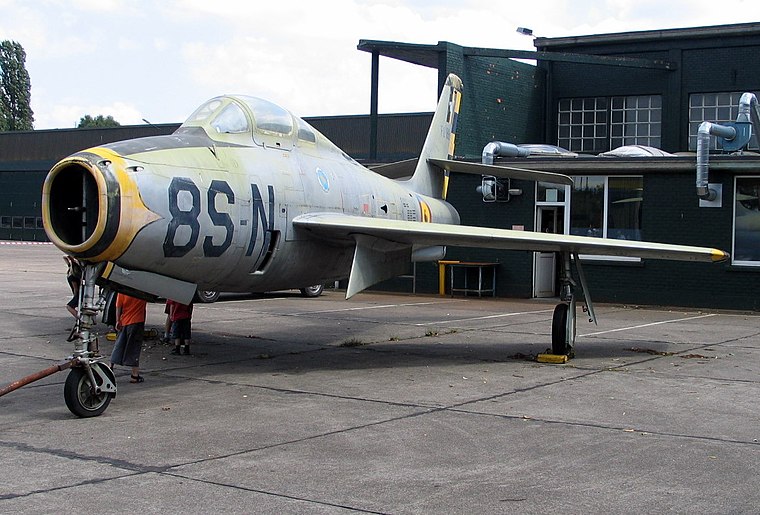
Photo: Paul Hermans, CC BY-SA 3.0.
Kleine Brogel Air Base is a Belgian Air Force military airfield located 0.8 nautical miles east of Kleine-Brogel, in the municipality of Peer, Belgium. Kleine Brogel Air Base is situated 3½ km west of Sporting Grote-Brogel.
Onze-Lieve-Vrouw-van-Lourdeskapel
Church

Photo: Dentonny, CC BY-SA 4.0.
Onze-Lieve-Vrouw-van-Lourdeskapel is a church, which is situated 2 km south of Sporting Grote-Brogel.
Places in the Area
Nearby places include Reppel and Bocholt.
Reppel
Village

Photo: Sonuwe, CC BY-SA 3.0.
Reppel is a village, which is situated 3 km east of Sporting Grote-Brogel.
Bocholt
Town
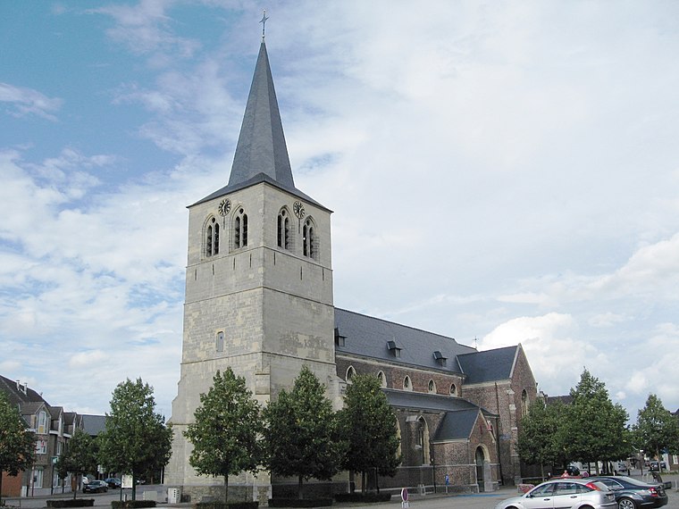
Photo: Sonuwe, CC BY-SA 3.0.
Bocholt is a municipality located in the Belgian province of Limburg. Bocholt is situated 4½ km east of Sporting Grote-Brogel.
Gerkenberg
Hamlet

Photo: Jonah Halfmann, CC BY 3.0.
Gerkenberg is a hamlet, which is situated 5 km southeast of Sporting Grote-Brogel.
Sporting Grote-Brogel
- Type: Pitch
- Categories: recreation area, football, and sports location
- Location: Peer, Arrondissement of Maaseik, Limburg, Flanders, Belgium, Benelux, Europe
- View on OpenStreetMap
Latitude
51.15808° or 51° 9′ 29″ northLongitude
5.51707° or 5° 31′ 1″ eastOpen location code
9F375G58+6ROpenStreetMap ID
way 206832778OpenStreetMap feature
leisure=pitchOpenStreetMap feature
sport=soccer
This page is based on OpenStreetMap, Wikidata, and Wikimedia Commons.
We’d love your help improving our open data sources. Thank you for contributing.
Satellite Map
Discover Sporting Grote-Brogel from above in high-definition satellite imagery.
Notable Places Nearby
Highlights include Kantine Sporting Grote-Brogel and Kapel en Heilig Hartbeeld.
Nearby Places
Explore places such as Western Saloon Pony Express and Grote-Brogel Breughel.
Limburg: Must-Visit Destinations
Delve into Sint-Truiden, Hasselt, Tongeren, and Genk.
Curious Pitches to Discover
Uncover intriguing pitches from every corner of the globe.
About Mapcarta. Data © OpenStreetMap contributors and available under the Open Database License". Text is available under the CC BY-SA 4.0 license, except for photos, directions, and the map. Photo: Wikimedia, CC BY 4.0.