Ferme Paelinck - Paelinckhoeve
Ferme Paelinck - Paelinckhoeve is a farmhouse in Ganshoren, Arrondissement of Brussels-Capital. Ferme Paelinck - Paelinckhoeve is situated nearby to the town Ganshoren, as well as near the apartment building Résidence Basilique.| Tap on a place to explore it |
Places of Interest Nearby
Highlights include Basilique Nationale du Sacré-Cœur and Rivieren Castle.
Basilique Nationale du Sacré-Cœur
Church

Photo: Giles Laurent, CC BY-SA 4.0.
The National Basilica of the Sacred Heart is a Catholic minor basilica and parish church in Brussels, Belgium. It is dedicated to the Sacred Heart, inspired by the Basilique du Sacré-Cœur in Paris. Basilique Nationale du Sacré-Cœur is situated 1 km southeast of Ferme Paelinck - Paelinckhoeve.
Rivieren Castle
Castle

Photo: Rharris, CC BY-SA 3.0.
Rivieren Castle is a 12th-century castle in Ganshoren, a municipality of Brussels, Belgium. The castle is surrounded by a pond, in a park of 10 hectares : Albert Park. Rivieren Castle is situated 650 metres northeast of Ferme Paelinck - Paelinckhoeve.
Church of St. Martin
Church
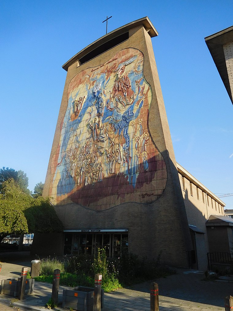
Photo: Grentidez, CC BY-SA 4.0.
Church of St. Martin is situated 550 metres east of Ferme Paelinck - Paelinckhoeve.
Places in the Area
Nearby places include Ganshoren and Cité Moderne - Moderne Wijk.
Ganshoren
Town

Photo: Michel wal, CC BY-SA 3.0.
Ganshoren is one of the 19 municipalities of the Brussels-Capital Region, Belgium. Located in the north-western part of the region, it is bordered by Berchem-Sainte-Agathe, Jette, and Koekelberg, as well as the Flemish municipality of Asse.
Cité Moderne - Moderne Wijk
Neighborhood

Photo: Ben2, CC BY-SA 3.0.
Cité Moderne - Moderne Wijk is a neighborhood.
Het Heideken
Neighborhood
Het Heideken is a district of Ganshoren, a municipality of Brussels, Belgium. The housing complex is uniquely shaped like a butterfly or kite and stretches across both sides of Avenue de l'Exposition Universelle/Wereldtentoonstellingslaan.
Ferme Paelinck - Paelinckhoeve
- Type: Farmhouse
- Categories: building and agriculture
- Location: Ganshoren, Arrondissement of Brussels-Capital, Brussels, Brussels Capital, Belgium, Benelux, Europe
- View on OpenStreetMap
Latitude
50.87158° or 50° 52′ 18″ northLongitude
4.30688° or 4° 18′ 25″ eastInception
1700—1799Open location code
9F26V8C4+JQOpenStreetMap ID
way 218995364OpenStreetMap feature
building=farm
This page is based on OpenStreetMap, Wikidata, and Wikimedia Commons.
We’d love your help improving our open data sources. Thank you for contributing.
Satellite Map
Discover Ferme Paelinck - Paelinckhoeve from above in high-definition satellite imagery.
In Other Languages
From Dutch to French—“Ferme Paelinck - Paelinckhoeve” goes by many names.
- Dutch: “Paelinckhoeve”
- French: “Ferme Paelinck”
Notable Places Nearby
Highlights include Administration communale de Ganshoren - Gemeentehuis Ganshoren and Résidence Basilique.
Nearby Places
Explore places such as Athénée Royal de Ganshoren – Section fondamentale and Pampoel.
Belgium: Must-Visit Destinations
Delve into Brussels, Antwerp, Ghent, and Liège.
Curious Farmhouses to Discover
Uncover intriguing farmhouses from every corner of the globe.
About Mapcarta. Data © OpenStreetMap contributors and available under the Open Database License". Text is available under the CC BY-SA 4.0 license, except for photos, directions, and the map. Photo: Hullie, CC BY-SA 3.0.