Ford Farm
Ford Farm is a farm in Rivenhall, Braintree District, England. Ford Farm is situated nearby to the forest Barrowfield Wood, as well as near Church of St Mary and All Saints.| Tap on a place to explore it |
Places of Interest Nearby
Highlights include Church of St Mary and All Saints and Cressing Temple.
Church of St Mary and All Saints
Church

Photo: Robert Edwards, CC BY-SA 2.0.
Church of St Mary and All Saints is situated 2,600 feet south of Ford Farm.
Cressing Temple
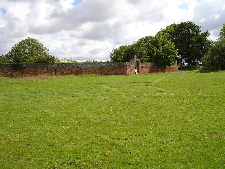
Photo: JohnArmagh, Public domain.
Cressing Temple is a medieval site situated between Witham and Braintree in Essex, close to the villages of Cressing and White Notley. It was amongst the very earliest and largest of the possessions of the Knights Templar in England, and is currently open to the public as a visitor attraction. Cressing Temple is situated 1½ miles west of Ford Farm.
St Francis‘ Church
Church

Photo: John Salmon, CC BY-SA 2.0.
St Francis‘ Church is situated 1¼ miles northwest of Ford Farm.
Places in the Area
Nearby places include Silver End and Rivenhall End.
Silver End
Village

Photo: ken brown, CC BY-SA 2.0.
Silver End is a garden village in between Witham and Braintree, in Essex, England. It was conceived in the 1920s as a model village by the industrialist Francis Henry Crittall, who established a Crittall Windows Ltd factory there to manufacture components for metal windows.
Rivenhall End
Village
Photo: Robert Edwards, CC BY-SA 2.0.
Rivenhall End is a hamlet in the civil parish of Rivenhall, near Witham, in the Braintree District in the county of Essex, England. It is near the village of Rivenhall. For transport there is the A12 nearby and Witham railway station.
Witham

Photo: Brenda Howard, CC BY-SA 2.0.
Witham is a town and civil parish in the Braintree district, in the county of Essex, England. In the 2011 census, it had a population of 25,353. It is twinned with the town of Waldbröl, Germany.
Ford Farm
- Type: Farm
- Category: agriculture
- Location: Rivenhall, Braintree District, Essex, East of England, England, United Kingdom, Britain and Ireland, Europe
- View on OpenStreetMap
Latitude
51.83607° or 51° 50′ 10″ northLongitude
0.65065° or 0° 39′ 2″ eastOpen location code
9F32RMP2+C7OpenStreetMap ID
way 242743998OpenStreetMap feature
landuse=farmyard
This page is based on OpenStreetMap, Wikidata, and Wikimedia Commons.
We’d love your help improving our open data sources. Thank you for contributing.
Satellite Map
Discover Ford Farm from above in high-definition satellite imagery.
Places with the Same Name
Discover other places named “Ford Farm”.
Notable Places Nearby
Highlights include Barrowfield Wood and Rivenhall Place.
Nearby Places
Explore places such as West Farm Cottage and Rivenhall Hall Farm.
Essex: Must-Visit Destinations
Delve into Colchester, Chelmsford, Southend-on-Sea, and Basildon.
Curious Farms to Discover
Uncover intriguing farms from every corner of the globe.
About Mapcarta. Data © OpenStreetMap contributors and available under the Open Database License". Text is available under the CC BY-SA 4.0 license, except for photos, directions, and the map. Photo: Wikimedia, CC0.