De Moester
De Moester is a farm in Ghent, East Flanders, Flanders. De Moester is situated nearby to the health club Fit Factory, as well as near the sports venue Sparkx.| Tap on a place to explore it |
Places of Interest Nearby
Highlights include Flanders Expo and Artevelde Tower.
Flanders Expo
Convention center

Photo: LimoWreck, CC BY-SA 3.0.
Flanders Expo is a multi-purpose arena and convention center located in Ghent, Flanders, Belgium. Flanders Expo was founded in 1986 and officially opened in May 1987 with the third edition of Flanders Technology International. Flanders Expo is situated 1 km north of De Moester.
Artevelde Tower
Office building
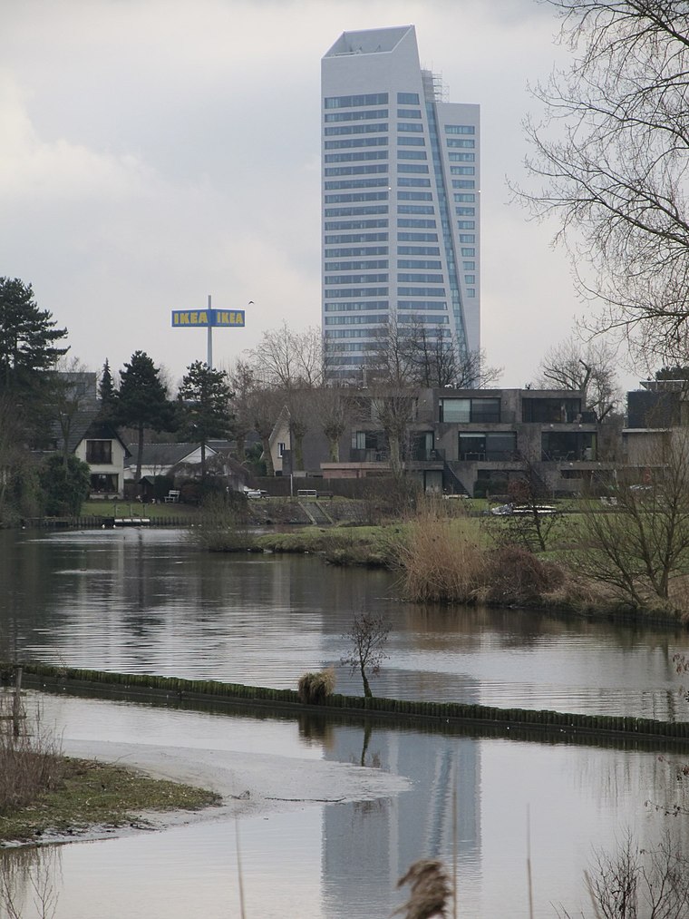 The Artevelde Tower is an office building in Ghent, Belgium. The tower is 118.5 metres and the highest building of Ghent and the highest office in the Flemish Region. Artevelde Tower is situated 390 metres northwest of De Moester.
Maaltebruggekasteel
Convention center
 Maaltebruggekasteel is a convention center, which is situated 1 km northeast of De Moester.
Places in the Area
Nearby places include Sint-Denijs-Westrem and Sint-Pieters-Aaigem.
Sint-Denijs-Westrem
Village

Photo: LimoWreck, CC BY-SA 3.0.
Sint-Denijs-Westrem is a sub-municipality of the city of Ghent located in the province of East Flanders, Flemish Region, Belgium. It was a separate municipality until 1977. On 1 January 1977, it was merged into Ghent.
Sint-Pieters-Aaigem
Neighborhood

Photo: Belgian man, CC BY-SA 3.0.
Sint-Pieters-Aaigem is a neighborhood.
Afsnee
Village

Photo: LimoWreck, CC BY-SA 3.0.
Afsnee is a sub-municipality of the city of Ghent located in the province of East Flanders, Flemish Region, Belgium. It was a separate municipality until 1977.
De Moester
- Type: Farm
- Category: agriculture
- Location: Ghent, Arrondissement of Ghent, East Flanders, Flanders, Belgium, Benelux, Europe
- View on OpenStreetMap
Latitude
51.0188° or 51° 1′ 8″ northLongitude
3.69017° or 3° 41′ 25″ eastOpen location code
9F352M9R+G3OpenStreetMap ID
way 242928136OpenStreetMap feature
landuse=farmyard
This page is based on OpenStreetMap, Wikidata, and Wikimedia Commons.
We’d love your help improving our open data sources. Thank you for contributing.
Satellite Map
Discover De Moester from above in high-definition satellite imagery.
Notable Places Nearby
Highlights include Fit Factory and Sparkx.
Nearby Places
Explore places such as Gent Rijvisschestraat and 123inkt.be.
East Flanders: Must-Visit Destinations
Delve into Aalst, Sint-Niklaas, Dendermonde, and Oudenaarde.
Curious Farms to Discover
Uncover intriguing farms from every corner of the globe.
About Mapcarta. Data © OpenStreetMap contributors and available under the Open Database License". Text is available under the CC BY-SA 4.0 license, except for photos, directions, and the map. Photo: Steve & Jem Copley, CC BY-SA 2.0.