Kanyon HaGivah
Kanyon HaGivah is a shopping center in Tel Aviv, Israel. Kanyon HaGivah is situated nearby to the park פארק אלקנה, as well as near the synagogue לכו נרננה (קרליבך).| Tap on a place to explore it |
Places of Interest Nearby
Highlights include Mayanei Hayeshua and Rabin Medical Center – Beilinson Campus.
Mayanei Hayeshua
Hospital
 Mayanei Hayeshua Medical Center is a Haredi hospital in Bnei Brak, Israel. Initially focusing on maternity, it is now a general hospital. MHMC's affairs are managed in strict accordance with halakha. Mayanei Hayeshua is situated 1¼ km northwest of Kanyon HaGivah.
Rabin Medical Center – Beilinson Campus
Hospital
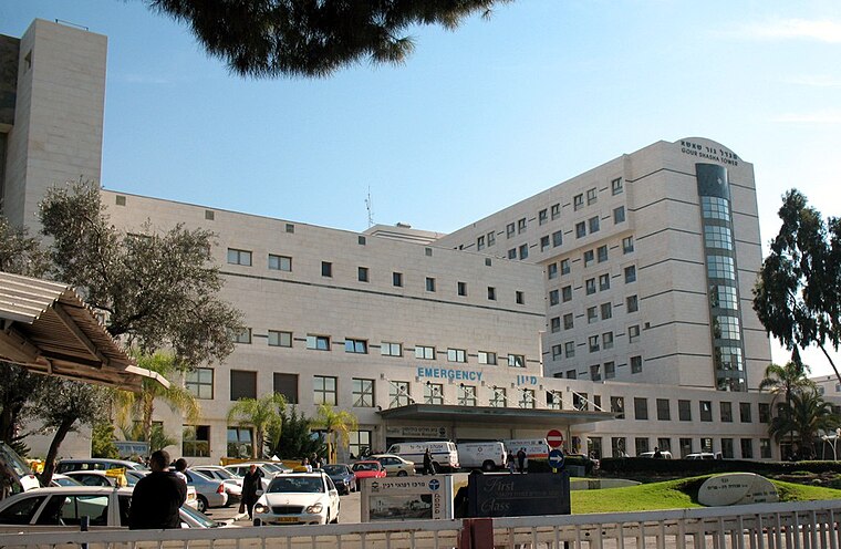
Photo: Wikimedia, Public domain.
Rabin Medical Center is a large general hospital located in Petah Tikva, Israel. It is owned and operated by Clalit Health Services, Israel's largest health maintenance organization. Rabin Medical Center – Beilinson Campus is situated 2 km northeast of Kanyon HaGivah.
Giv’at Shmuel High School
School

Photo: Wikimedia, CC BY-SA 3.0.
Giv’at Shmuel High School is situated 1 km southwest of Kanyon HaGivah.
Places in the Area
Nearby places include Givat Shmuel and Neve Oz.
Givat Shmuel

Photo: מיכאלי, CC BY-SA 3.0.
Givat Shmuel is a small city of nearly 30,000 in Israel. It is in the Center District, which also includes Tel Aviv, Bnei Brak, and Petah Tikva.


Kanyon HaGivah
- Type: Shopping center
- Also known as: “HaGivah Mall” and “Kanyon HaGiva”
- Category: shop
- Location: Tel Aviv, Israel, Middle East, Asia
- View on OpenStreetMap
Latitude
32.0762° or 32° 4′ 34″ northLongitude
34.85474° or 34° 51′ 17″ eastOpen location code
8G4P3VG3+FVOpenStreetMap ID
way 255711312OpenStreetMap feature
shop=mall
This page is based on OpenStreetMap, Wikidata, and Wikimedia Commons.
We’d love your help improving our open data sources. Thank you for contributing.
Satellite Map
Discover Kanyon HaGivah from above in high-definition satellite imagery.
In Other Languages
“Kanyon HaGivah” goes by many names.
- Hebrew: “קניון הגבעה”
Notable Places Nearby
Highlights include פארק אלקנה and לכו נרננה (קרליבך).
Nearby Places
Explore places such as HaGiv’a Mall/Yoni Netanyahu and Menachem Begin Boulevard/Hayim Nahman Bialik.
Israel: Must-Visit Destinations
Delve into Tel Aviv, Carmel Range, Haifa, and Nazareth.
Curious Shopping Centers to Discover
Uncover intriguing shopping centers from every corner of the globe.
About Mapcarta. Data © OpenStreetMap contributors and available under the Open Database License". Text is available under the CC BY-SA 4.0 license, except for photos, directions, and the map. Photo: Bienchido, CC BY-SA 3.0.