Oxford University Press
Oxford University Press is in Oxford, Oxfordshire, England, and is located on Great Clarendon Street. Oxford University Press is situated nearby to the bar Freud, as well as near the grassland Park Lawn.| Tap on a place to explore it |
Places of Interest Nearby
Highlights include Somerville College and Worcester College.
Somerville College
University
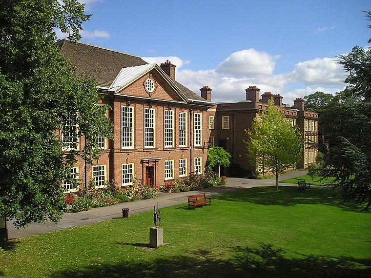
Photo: Wikimedia, CC BY-SA 3.0.
Somerville College is a constituent college of the University of Oxford in England. It was founded in 1879 as Somerville Hall, one of its first two women's colleges. Somerville College is situated 650 feet northeast of Oxford University Press.
Worcester College
University

Photo: Wikimedia, Public domain.
Worcester College is a constituent college of the University of Oxford in England. The college was founded in 1714 by the benefaction of Sir Thomas Cookes, 2nd Baronet of Norgrove, Worcestershire, whose coat of arms was adopted by the college. Worcester College is situated 1,100 feet south of Oxford University Press.
Green Templeton College
University
 Green Templeton College is a constituent college of the University of Oxford in the United Kingdom. The college is located on the former Green College site on Woodstock Road next to the Radcliffe Observatory Quarter in North Oxford and is centred on the architecturally important Radcliffe Observatory, an 18th-century building, modelled on the ancient Tower of the Winds at Athens. Green Templeton College is situated 1,200 feet northeast of Oxford University Press.
Places in the Area
Nearby places include Jericho and Oxford.
Jericho
Suburb

Photo: Wikimedia, Public domain.
Jericho is a historic suburb of the English city of Oxford. It consists of the streets bounded by the Oxford Canal, Worcester College, Walton Street and Walton Well Road.
Oxford

Photo: Diliff, CC BY-SA 3.0.
Oxford is the oldest university city in the United Kingdom, some 50 miles to the west of the capital London in its own county of Oxfordshire, on the rivers Thames and Cherwell.
Norham Manor
Quarter

Photo: Jpbowen, CC BY-SA 3.0.
The Norham Manor estate is a residential suburb in Oxford, England. It is part of central North Oxford. To the north is Park Town with its crescents, to the east is the River Cherwell, to the south are the University Parks and to the west is Walton Manor, on the other side of Banbury Road.
Oxford University Press
- Type: Commerce
- Address: Great Clarendon Street, OX2 6DP
- Location: Oxford, Oxfordshire, South East England, England, United Kingdom, Britain and Ireland, Europe
- View on OpenStreetMap
Latitude
51.75829° or 51° 45′ 30″ northLongitude
-1.26546° or 1° 15′ 56″ westOpen location code
9C3WQP5M+8ROpenStreetMap ID
way 25611290OpenStreetMap feature
landuse=commercial
This page is based on OpenStreetMap, Wikidata, and Wikimedia Commons.
We’d love your help improving our open data sources. Thank you for contributing.
Satellite Map
Discover Oxford University Press from above in high-definition satellite imagery.
In Other Languages
“Oxford University Press” goes by many names.
- Japanese: “オックスフォード大学出版局”
Places with the Same Name
Discover other places named “Oxford University Press”.
Notable Places Nearby
Highlights include Freud and Park Lawn.
Nearby Places
Explore places such as Launder2Go and Walton Stationers.
Oxfordshire: Must-Visit Destinations
Delve into Oxford, Abingdon-on-Thames, Banbury, and Woodstock.
Curious Places to Discover
Uncover intriguing places from every corner of the globe.
About Mapcarta. Data © OpenStreetMap contributors and available under the Open Database License". Text is available under the CC BY-SA 4.0 license, except for photos, directions, and the map. Photo: Wikimedia, CC0.