Stationstraat
Stationstraat is a parking area in Wevelgem, Arrondissement of Kortrijk, Flanders. Stationstraat is situated nearby to the railway station Wevelgem, as well as near the place of worship Lourdesgrot.| Tap on a place to explore it |
Places of Interest Nearby
Highlights include Sint-Hilariuskerk and Wevelgem Communal Cemetery.
Sint-Hilariuskerk
Church
 Sint-Hilariuskerk is a church, which is situated 260 metres south of Stationstraat.
Wevelgem Communal Cemetery
Cemetery

Photo: Wernervc, CC BY-SA 4.0.
Wevelgem Communal Cemetery is situated 530 metres southwest of Stationstraat.
Flanders International Airport
Aerodrome
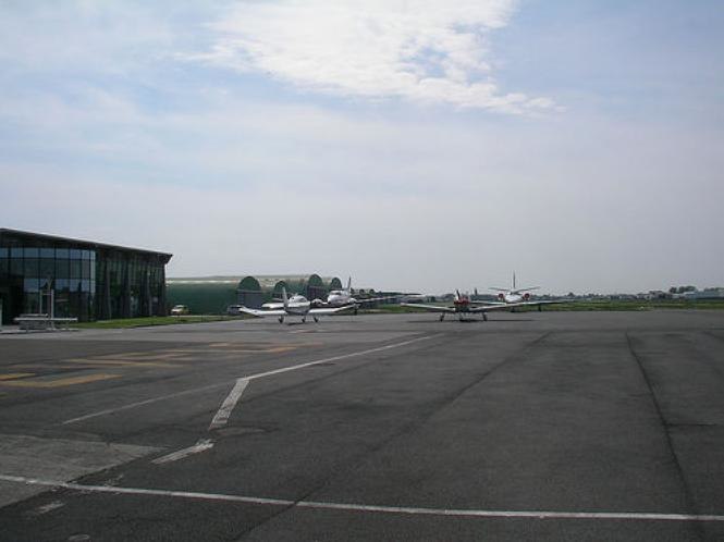
Photo: Speha702, CC BY-SA 3.0.
Flanders International Airport, Flanders Airport or Kortrijk-Wevelgem International Airport is an airport located in the town of Wevelgem, West Flanders in the Flemish Region of Belgium and partly also in the Bissegem section of the city of Kortrijk (2 nautical miles west.
Places in the Area
Nearby places include Wevelgem and Rekkem.
Wevelgem
Village
 Wevelgem is a municipality located in the Belgian province of West Flanders. The municipality comprises the towns of Gullegem, Moorsele and Wevelgem proper.
Rekkem
Suburb
 Rekkem is a section of the Belgian city of Menen, in the province of West Flanders. Until 1977, it was an independent municipality. It was called Retchème in Picard. Rekkem is situated 3 km southwest of Stationstraat.
Bissegem
Village
 Bissegem is a sub-municipality of the city of Kortrijk, Belgium. It is part of the urban area of this city. As of 2020 it had a population of 5,283. It also has a railway station, with trains to leper, Kortrijk, Dendermonde, Sint-Niklaas and Brussels. Bissegem is situated 3½ km northeast of Stationstraat.
Stationstraat
- Type: Parking area
- Parking: surface
- Category: transportation
- Location: Wevelgem, Arrondissement of Kortrijk, West Flanders, Flanders, Belgium, Benelux, Europe
- View on OpenStreetMap
Latitude
50.81162° or 50° 48′ 42″ northLongitude
3.18405° or 3° 11′ 3″ eastOpen location code
9F25R56M+JJOpenStreetMap ID
way 271840417OpenStreetMap feature
amenity=parkingOpenStreetMap attribute
parking=surface
This page is based on OpenStreetMap, Wikidata, and Wikimedia Commons.
We’d love your help improving our open data sources. Thank you for contributing.
Satellite Map
Discover Stationstraat from above in high-definition satellite imagery.
Notable Places Nearby
Highlights include Wevelgem and Brandweer Wevelgem.
Nearby Places
Explore places such as SW+ and SW+.
West Flanders: Must-Visit Destinations
Delve into Bruges, Kortrijk, Ypres, and Ostend.
Curious Parking Areas to Discover
Uncover intriguing parking areas from every corner of the globe.
About Mapcarta. Data © OpenStreetMap contributors and available under the Open Database License". Text is available under the CC BY-SA 4.0 license, except for photos, directions, and the map. Photo: MJJR, CC BY 3.0.