Industriezone Gullegem-Moorsele
Industriezone Gullegem-Moorsele is in Wevelgem, Arrondissement of Kortrijk, Flanders. Industriezone Gullegem-Moorsele is situated nearby to the sports venue Yeti Gullegem, as well as near the village Rollegem-Kapelle.| Tap on a place to explore it |
Places of Interest Nearby
Highlights include Sint-Amanduskerk and Moorsele.
Sint-Amanduskerk
Church
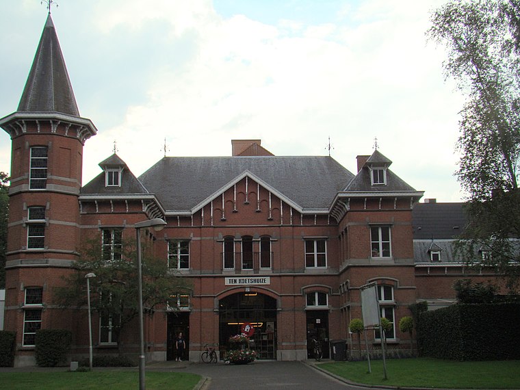
 Sint-Amanduskerk is a church, which is situated 1½ km southeast of Industriezone Gullegem-Moorsele.
Moorsele
Aerodrome
 Moorsele Airfield is a recreational airfield located in Moorsele, a village in the municipality of Wevelgem in Belgium. It is operated by Vliegveld Moorsele VZW and was formerly operated by the Belgian Air Component. Moorsele is situated 3 km west of Industriezone Gullegem-Moorsele.
Kasteel van Moorsele
Castle

Photo: Graindorkof, CC BY-SA 3.0.
Kasteel van Moorsele is a castle, which is situated 2 km southwest of Industriezone Gullegem-Moorsele.
Places in the Area
Nearby places include Rollegem-Kapelle and Heule.
Rollegem-Kapelle
Village

Photo: Spotter2, CC BY-SA 3.0.
Rollegem-Kapelle is a village, which is situated 3½ km northwest of Industriezone Gullegem-Moorsele.
Heule
Village
 Heule is a submunicipality of the city of Kortrijk in the Belgian province of West Flanders. The first notion of this settlement date of the year 1111. Heule is situated 3½ km east of Industriezone Gullegem-Moorsele.
Sint-Katrien
Hamlet

Photo: Spotter2, CC BY-SA 4.0.
Sint-Katrien is a hamlet, which is situated 4 km northeast of Industriezone Gullegem-Moorsele.
Industriezone Gullegem-Moorsele
- Type: Industry
- Location: Wevelgem, Arrondissement of Kortrijk, West Flanders, Flanders, Belgium, Benelux, Europe
- View on OpenStreetMap
Latitude
50.85393° or 50° 51′ 14″ northLongitude
3.18853° or 3° 11′ 19″ eastOpen location code
9F25V53Q+HCOpenStreetMap ID
way 276796921OpenStreetMap feature
landuse=industrial
This page is based on OpenStreetMap, Wikidata, and Wikimedia Commons.
We’d love your help improving our open data sources. Thank you for contributing.
Satellite Map
Discover Industriezone Gullegem-Moorsele from above in high-definition satellite imagery.
Places with the Same Name
Discover other places named “Industriezone Gullegem-Moorsele”.
Notable Places Nearby
Highlights include Yeti Gullegem and Brandweer Gullegem-Moorsele.
Nearby Places
Explore places such as Districo and Gullegem Ballingbos.
West Flanders: Must-Visit Destinations
Delve into Bruges, Kortrijk, Ypres, and Ostend.
Curious Places to Discover
Uncover intriguing places from every corner of the globe.
About Mapcarta. Data © OpenStreetMap contributors and available under the Open Database License". Text is available under the CC BY-SA 4.0 license, except for photos, directions, and the map. Photo: MJJR, CC BY 3.0.