Vrije Basisschool Sint-Katrien
Vrije Basisschool Sint-Katrien is a school in Kuurne, Arrondissement of Kortrijk, Flanders. Vrije Basisschool Sint-Katrien is situated nearby to the church Sint-Katrienkerk, as well as near the community center Buurthuis ‘t Senter.| Tap on a place to explore it |
Places of Interest Nearby
Highlights include Sint-Blasiuskerk and Lendelede Communal Cemetery.
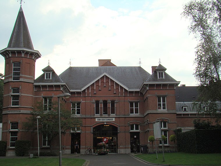
Sint-Blasiuskerk
Church

Photo: MADe, CC BY-SA 2.0 be.
Sint-Blasiuskerk is a church, which is situated 1½ km north of Vrije Basisschool Sint-Katrien.
Lendelede Communal Cemetery
Cemetery

Photo: Wernervc, CC BY-SA 4.0.
Lendelede Communal Cemetery is situated 1½ km north of Vrije Basisschool Sint-Katrien.
Sint-Pieterskerk
Church
 Sint-Pieterskerk is a church, which is situated 2½ km southeast of Vrije Basisschool Sint-Katrien.
Places in the Area
Nearby places include Sint-Katrien and Lendelede.

Lendelede
Village

Photo: Spotter2, CC BY-SA 4.0.
Lendelede is a municipality located in the Belgian province of West Flanders. The municipality comprises only the town of Lendelede proper. On January 1, 2006, Lendelede had a total population of 5,399. The total area is 13.15 km.
Heule
Village
 Heule is a submunicipality of the city of Kortrijk in the Belgian province of West Flanders. The first notion of this settlement date of the year 1111. Heule is situated 3 km south of Vrije Basisschool Sint-Katrien.
Vrije Basisschool Sint-Katrien
- Type: School
- Category: education
- Location: Kuurne, Arrondissement of Kortrijk, West Flanders, Flanders, Belgium, Benelux, Europe
- View on OpenStreetMap
Latitude
50.87228° or 50° 52′ 20″ northLongitude
3.24096° or 3° 14′ 28″ eastOpen location code
9F25V6CR+W9OpenStreetMap ID
way 277646756OpenStreetMap feature
amenity=school
This page is based on OpenStreetMap, Wikidata, and Wikimedia Commons.
We’d love your help improving our open data sources. Thank you for contributing.
Satellite Map
Discover Vrije Basisschool Sint-Katrien from above in high-definition satellite imagery.
Notable Places Nearby
Highlights include Sint-Katrienkerk and Buurthuis ‘t Senter.
Nearby Places
Explore places such as Spar Sentemarkt and Lendelede Sint-Katharinakerk.
West Flanders: Must-Visit Destinations
Delve into Bruges, Kortrijk, Ypres, and Ostend.
Curious Places to Discover
Uncover intriguing places from every corner of the globe.
About Mapcarta. Data © OpenStreetMap contributors and available under the Open Database License". Text is available under the CC BY-SA 4.0 license, except for photos, directions, and the map. Photo: MJJR, CC BY 3.0.