Centre culturel Jean Wolff
Centre culturel Jean Wolff is a building in Hobscheid, Capellen. Centre culturel Jean Wolff is situated nearby to Place Denn, as well as near the village Eischen.| Tap on a place to explore it |
Places of Interest Nearby
Highlights include Église Saint-Pierre and Rentert Chapel.
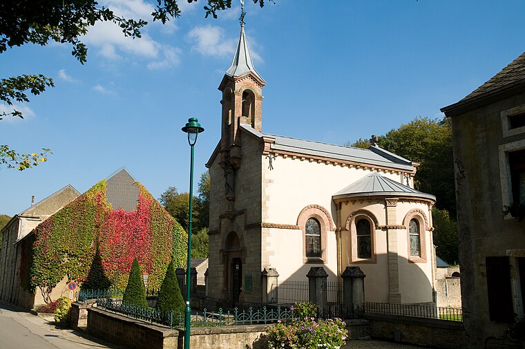
Église Saint-Pierre
Church

Photo: Cathar maiden, Public domain.
Église Saint-Pierre is a church, which is situated 320 metres north of Centre culturel Jean Wolff.
Rentert Chapel
Church

Photo: MMFE, CC BY-SA 3.0.
Rentert Chapel is a church, which is situated 1¼ km west of Centre culturel Jean Wolff.
Clairefontaine Abbey
Ruins

Photo: Grentidez, Public domain.
The Abbey of Notre-Dame de Clairefontaine was a monastery of Cistercian nuns founded in the middle of the 13th century and officially suppressed in 1796. Clairefontaine Abbey is situated 2 km southwest of Centre culturel Jean Wolff.
Places in the Area
Nearby places include Eischen and Clairefontaine.
Eischen
Village
 Eischen is the largest town in the commune of Habscht in south-western Luxembourg, and its administrative centre. As of 2023, the town has a population of 2,206.
Hobscheid
Village

Photo: Les Meloures, CC BY-SA 3.0.
Hobscheid is a town in western Luxembourg. It is part of the commune of Habscht, in the canton of Capellen, which is part of the district of Luxembourg. Hobscheid is situated 2½ km east of Centre culturel Jean Wolff.
Centre culturel Jean Wolff
- Type: Building
- Location: Hobscheid, Capellen, Luxembourg, Benelux, Europe
- View on OpenStreetMap
Latitude
49.68342° or 49° 41′ 0″ northLongitude
5.87817° or 5° 52′ 41″ eastOpen location code
8FX7MVMH+97OpenStreetMap ID
way 282110310OpenStreetMap feature
building=yes
This page is based on OpenStreetMap, Wikidata, and Wikimedia Commons.
We’d love your help improving our open data sources. Thank you for contributing.
Satellite Map
Discover Centre culturel Jean Wolff from above in high-definition satellite imagery.
Notable Places Nearby
Highlights include Place Denn and Centre Polyvalent Eischen.
Nearby Places
Explore places such as Denn Mairie and S-Bank.
Luxembourg: Must-Visit Destinations
Delve into Luxembourg, Central Luxembourg, Schengen, and Echternach.
Curious Buildings to Discover
Uncover intriguing buildings from every corner of the globe.
About Mapcarta. Data © OpenStreetMap contributors and available under the Open Database License". Text is available under the CC BY-SA 4.0 license, except for photos, directions, and the map. Photo: Michal Osmenda, CC BY-SA 2.0.