Vakantiepark De Bremakker
Vakantiepark De Bremakker is a chalet in North Holland, Western Netherlands. Vakantiepark De Bremakker is situated nearby to the playground Vredelust, as well as near Gerritslanderdijkje 86.| Tap on a place to explore it |
Places of Interest Nearby
Highlights include Ecomare and Texel (Den Burg) Cemetery.
Ecomare
Zoo
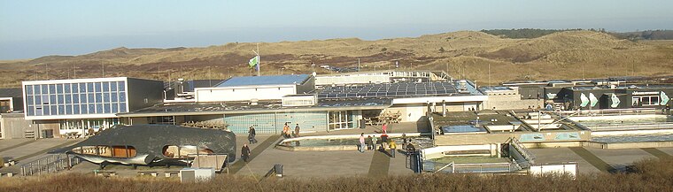
Photo: Traitor, CC BY-SA 3.0.
Duinen van Texel National Park is a national park located on the North Holland island of Texel in the Netherlands. All dune systems on the western side of the island and the large coastal plains on both the northern and southern points of the island are part of the park. Ecomare is situated 1 km northwest of Vakantiepark De Bremakker.
Texel (Den Burg) Cemetery
Cemetery

Photo: Pa3ems, CC BY-SA 3.0.
Texel (Den Burg) Cemetery is situated 3 km southeast of Vakantiepark De Bremakker.
Waalenburg
Nature reserve

Photo: WeeJeeVee, CC BY-SA 4.0.
Waalenburg is a nature reserve, which is situated 4 km east of Vakantiepark De Bremakker.
Places in the Area
Nearby places include De Koog and Den Burg.
De Koog
Village
 De Koog is a village in the Dutch province of North Holland. It is a part of the municipality of Texel, and lies about 17 km north of Den Helder. It is the chief centre of tourism on the island, surrounded with many hotels and campgrounds. De Koog is situated 3 km north of Vakantiepark De Bremakker.
Den Burg
Town

Photo: Paul van de Velde, CC BY 2.0.
Den Burg is a town in the Dutch province of North Holland. It is a part of the municipality of Texel on the island of the same name, and lies about 12 km north of Den Helder. Den Burg is situated 3 km southeast of Vakantiepark De Bremakker.
Texel

Photo: Jerreantwerp, Public domain.
Texel is an island in the West Frisian Islands region of the Netherlands. Tourists and birds are abundant. The tourists visit mostly in the summer. Texel is an island with four types of landscape: dunes and beaches in the west, flatland and polders in the east and hilly in the center of the island.
Vakantiepark De Bremakker
- Type: Chalet
- Categories: tourism, accommodation, and building
- Location: North Holland, Western Netherlands, Netherlands, Benelux, Europe
- View on OpenStreetMap
Latitude
53.07222° or 53° 4′ 20″ northLongitude
4.75758° or 4° 45′ 27″ eastOpen location code
9F563QC5+V2OpenStreetMap ID
way 309406170OpenStreetMap feature
tourism=chalet
This page is based on OpenStreetMap, Wikidata, and Wikimedia Commons.
We’d love your help improving our open data sources. Thank you for contributing.
Satellite Map
Discover Vakantiepark De Bremakker from above in high-definition satellite imagery.
Notable Places Nearby
Highlights include Vredelust and Gerritslanderdijkje 86.
Nearby Places
Explore places such as Info Campongplatz and housenumber 293.
North Holland: Must-Visit Destinations
Delve into Amsterdam, Haarlem, Alkmaar, and Schiphol Airport.
Curious Chalets to Discover
Uncover intriguing chalets from every corner of the globe.
About Mapcarta. Data © OpenStreetMap contributors and available under the Open Database License". Text is available under the CC BY-SA 4.0 license, except for photos, directions, and the map. Photo: Arch, Public domain.