Noir et Blanc
Noir et Blanc is a restaurant in Esch-sur-Alzette, Luxembourg which is located on Rue Guillaume Capus. Noir et Blanc is situated nearby to the square Place Adeline Pellegrino, as well as near the government office Société Nationale de Circulation Automobile.| Tap on a place to explore it |
- Opening hours:
Tuesday—Saturday: noon—2:00 PM and 6:00 PM—11:00 PM
Sunday: noon—2:00 PM - Type: Restaurant
- Cuisine: Italian
- Address: 22 Rue Guillaume Capus, Esch-sur-Alzette, 4071
Places of Interest Nearby
Highlights include Lycée Hubert Clément and Saint Henri Church of Esch-sur-Alzette.
Lycée Hubert Clément
School

Photo: Zinneke, CC BY-SA 3.0.
Lycée Hubert Clément, abbreviated to LHCE, is a high school in Esch-sur-Alzette, in south-western Luxembourg. It was founded as a single-sex girls school in 1955, paralleling Esch's all-boys school, Lycée de Garçons Esch-sur-Alzette, and was named Lycée de Jeunes Filles à Esch-sur-Alzette. Lycée Hubert Clément is situated 680 metres south of Noir et Blanc.
Saint Henri Church of Esch-sur-Alzette
Church
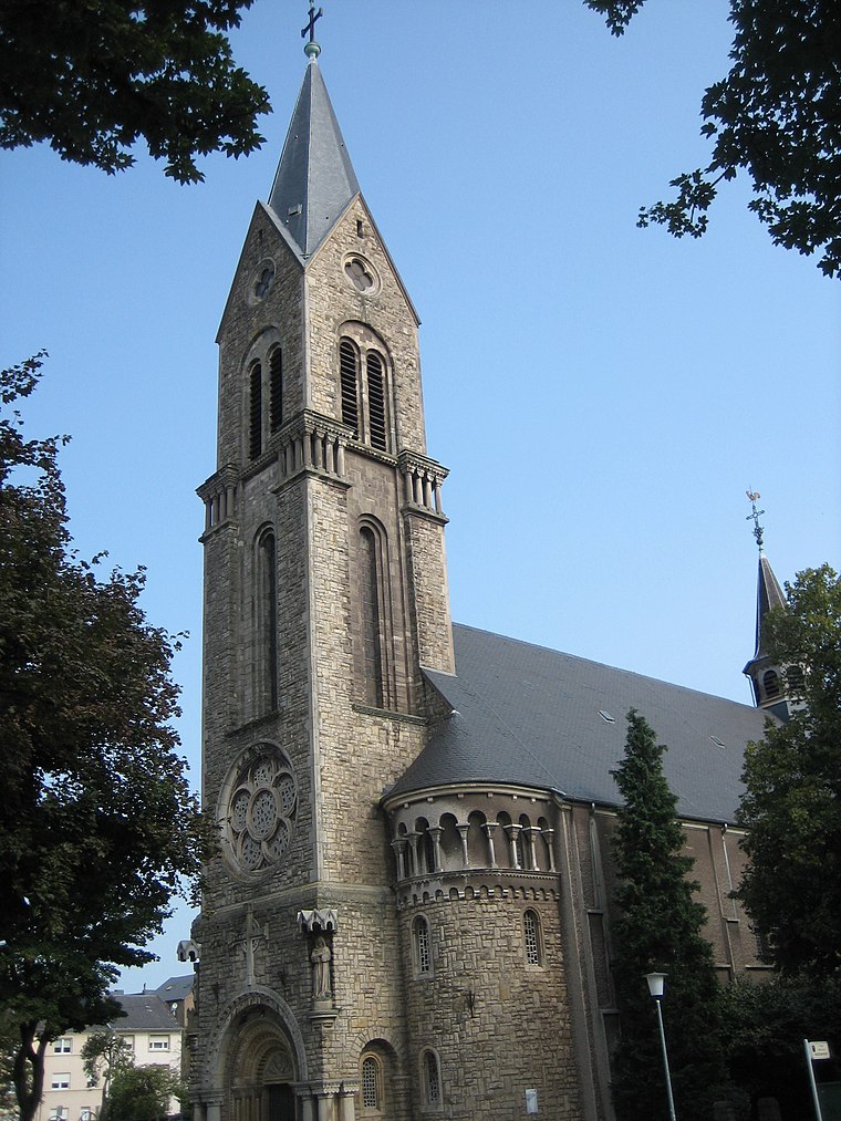
Photo: Zinneke, CC BY-SA 3.0.
Saint Henri Church of Esch-sur-Alzette is situated 1 km south of Noir et Blanc.
National Resistance Museum, Luxembourg
Museum

Photo: Cayambe, CC BY-SA 4.0.
The National Museum of Resistance and Human Rights is located in the centre of Esch-sur-Alzette in the south-west of Luxembourg. The specially designed building traces the history of Luxembourg from 1940 to 1945 under the Nazi oppression, through the reactions of the people, until liberation, by photos, objects and works of art. National Resistance Museum, Luxembourg is situated 2 km south of Noir et Blanc.
Places in the Area
Nearby places include Land of the Red Rocks and Esch-sur-Alzette.
Land of the Red Rocks
The Land of the Red Rocks, also known as the Esch-sur-Alzette canton, is the southwestmost region of Luxembourg.Esch-sur-Alzette
Town

Photo: Zinneke, CC BY-SA 4.0.
The Land of the Red Rocks, also known as the Esch-sur-Alzette canton, is the southwestmost region of Luxembourg.
Ehlerange
Village

Photo: Pecalux, CC BY-SA 3.0 lu.
Ehlerange is a small town in the commune of Sanem, in south-western Luxembourg. As of 2024, the town has a population of 983.
Noir et Blanc
- Categories: building, commercial building, and food
- Location: Esch-sur-Alzette, Luxembourg, Benelux, Europe
- View on OpenStreetMap
Latitude
49.50855° or 49° 30′ 31″ northLongitude
5.97533° or 5° 58′ 31″ eastOpen location code
8FX7GX5G+C4OpenStreetMap ID
way 338608546OpenStreetMap feature
amenity=restaurantOpenStreetMap feature
building=commercialOpenStreetMap attribute
cuisine=italian
This page is based on OpenStreetMap, Wikidata, and Wikimedia Commons.
We’d love your help improving our open data sources. Thank you for contributing.
Satellite Map
Discover Noir et Blanc from above in high-definition satellite imagery.
Notable Places Nearby
Highlights include Place Adeline Pellegrino and Société Nationale de Circulation Automobile.
Nearby Places
Explore places such as Esch, Rue Guillaume Capus and Esch, Schluechthaus.
Luxembourg: Must-Visit Destinations
Delve into Luxembourg, Central Luxembourg, Schengen, and Echternach.
Curious Restaurants to Discover
Uncover intriguing restaurants from every corner of the globe.
About Mapcarta. Data © OpenStreetMap contributors and available under the Open Database License". Text is available under the CC BY-SA 4.0 license, except for photos, directions, and the map. Photo: Michal Osmenda, CC BY-SA 2.0.