Chiesa Evangelica Luterana
Chiesa Evangelica Luterana is a church in Trieste, Friuli-Venezia Giulia. Chiesa Evangelica Luterana is situated nearby to Largo Odorico Panfili, as well as near the government office Agenzia delle Dogane e dei Monopoli.| Tap on a place to explore it |
Places of Interest Nearby
Highlights include Trieste Centrale railway station and Postal and Telegraphic Museum of Central Europe.
Trieste Centrale railway station
Railway station

Photo: Simon04, CC BY-SA 4.0.
Trieste Centrale railway station is the main station serving the city and municipality of Trieste, in the autonomous region of Friuli-Venezia Giulia, northeastern Italy. Trieste Centrale railway station is situated 310 metres north of Chiesa Evangelica Luterana.
Piazza Vittorio Veneto
Square
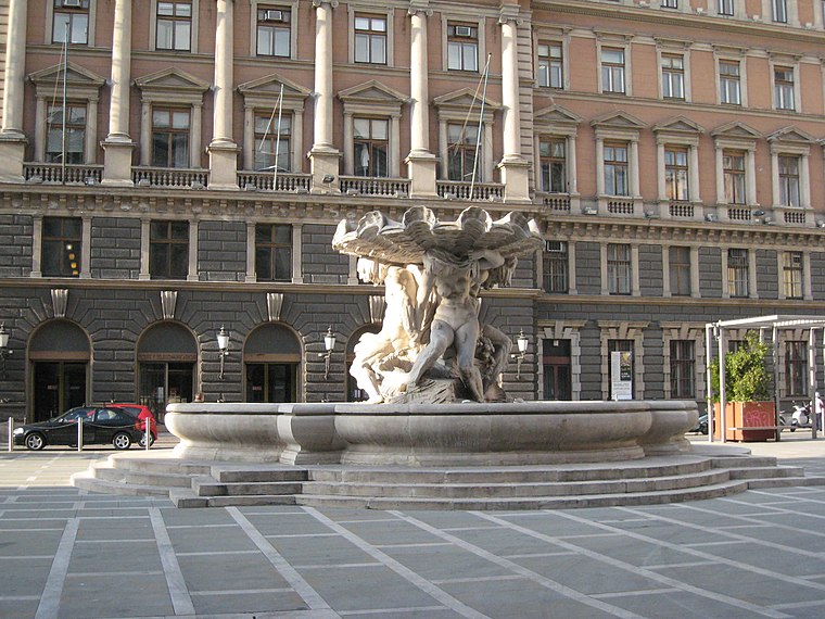
Photo: Tiesse, Public domain.
Piazza Vittorio Veneto is a square, which is situated 130 metres southeast of Chiesa Evangelica Luterana.
Places in the Area
Nearby places include Chiadino and Sottomonte.

Barcola
Suburb

Photo: Tiesse, Public domain.
Barcola is a maritime neighbourhood of Trieste, Italy. It is a popular tourist destination with beaches and long promenades, near the Habsburg-established Miramare Castle. Barcola is situated 3 km northwest of Chiesa Evangelica Luterana.
Chiesa Evangelica Luterana
- Type: Church
- Denomination: Lutheran
- Categories: building, place of worship, and religion
- Location: Trieste, Province of Trieste, Friuli-Venezia Giulia, Northeast Italy, Italy, Europe
- View on OpenStreetMap
Latitude
45.65502° or 45° 39′ 18″ northLongitude
13.77222° or 13° 46′ 20″ eastOpen location code
8FQMMQ4C+2VOpenStreetMap ID
way 36684706OpenStreetMap feature
amenity=place_of_worshipOpenStreetMap feature
building=churchOpenStreetMap attribute
denomination=lutheran
This page is based on OpenStreetMap, Wikidata, and Wikimedia Commons.
We’d love your help improving our open data sources. Thank you for contributing.
Satellite Map
Discover Chiesa Evangelica Luterana from above in high-definition satellite imagery.
Places with the Same Name
Discover other places named “Chiesa Evangelica Luterana”.
Notable Places Nearby
Highlights include Largo Odorico Panfili and Agenzia delle Dogane e dei Monopoli.
Nearby Places
Explore places such as Cantiere Panfilli and Affittacamere Iris.
Friuli-Venezia Giulia: Must-Visit Destinations
Delve into Udine, Aquileia, Gorizia, and Pordenone.
Curious Churches to Discover
Uncover intriguing churches from every corner of the globe.
About Mapcarta. Data © OpenStreetMap contributors and available under the Open Database License". Text is available under the CC BY-SA 4.0 license, except for photos, directions, and the map. Photo: Dodos2013, CC BY-SA 3.0.