Vivero Municipal de Oviedo
Vivero Municipal de Oviedo is a greenhouse in Oviedo, Asturias. Vivero Municipal de Oviedo is situated nearby to the park Parque Purificación Tomás, as well as near the cemetery Cementerio municipal del Naranco.| Tap on a place to explore it |
Places of Interest Nearby
Highlights include Santa María del Naranco and San Miguel de Lillo.
Santa María del Naranco
Church

Photo: Fernando, CC BY-SA 4.0.
The church of Saint Mary at Mount Naranco is a pre-Romanesque Asturian building on the slope of Mount Naranco situated 3 kilometres from Oviedo, northern Spain. Santa María del Naranco is situated 800 metres northeast of Vivero Municipal de Oviedo.
San Miguel de Lillo
Church

Photo: Fernando, CC BY-SA 4.0.
St. Michael of Lillo is a Roman Catholic church built on the Naranco mount, near the Church of Santa María del Naranco in Asturias. It was completed in 842 and it was consecrated by Ramiro I of Asturias and his wife Paterna in the year 848. San Miguel de Lillo is situated 790 metres northeast of Vivero Municipal de Oviedo.
Estadio Carlos Tartiere
Stadium
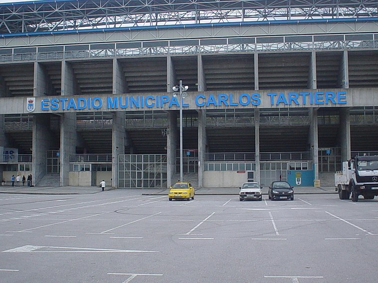
Photo: Rsg, CC BY-SA 2.5 es.
Estadio Municipal Carlos Tartiere is a multi-use stadium in Oviedo, Spain. With a capacity of 30,500 seats, it is the 17th-largest stadium in Spain and the largest in Asturias. Estadio Carlos Tartiere is situated 1½ km south of Vivero Municipal de Oviedo.
Places in the Area
Nearby places include Llano and Buenavista.


San Claudio
Village

Photo: Carmenmoran, CC BY 4.0.
San Claudio is a town situated in the municipality of Oviedo, Spain. It lies three kilometers and a half from Oviedo. It is named after Saint Claudius, a martyr of León, Spain. San Claudio is situated 4 km southwest of Vivero Municipal de Oviedo.
Vivero Municipal de Oviedo
- Type: Greenhouse
- Location: Oviedo, Asturias, Green Spain, Spain, Iberia, Europe
- View on OpenStreetMap
Latitude
43.37401° or 43° 22′ 26″ northLongitude
-5.87299° or 5° 52′ 23″ westOpen location code
8CMP94FG+JROpenStreetMap ID
way 36895279OpenStreetMap feature
landuse=greenhouse_horticulture
This page is based on OpenStreetMap, Wikidata, and Wikimedia Commons.
We’d love your help improving our open data sources. Thank you for contributing.
Satellite Map
Discover Vivero Municipal de Oviedo from above in high-definition satellite imagery.
Notable Places Nearby
Highlights include Parque Purificación Tomás and Cementerio municipal del Naranco.
Nearby Places
Explore places such as Carretera de Ules and Hospital Monte Naranco.
Asturias: Must-Visit Destinations
Delve into Gijón, Villaviciosa, Grado, and Salas.
Curious Greenhouses to Discover
Uncover intriguing greenhouses from every corner of the globe.
About Mapcarta. Data © OpenStreetMap contributors and available under the Open Database License". Text is available under the CC BY-SA 4.0 license, except for photos, directions, and the map. Photo: Wikimedia, CC0.