Bip Information Professionnelle
Bip Information Professionnelle is a building in Saint-Thibéry, Arrondissement of Béziers, Occitanie. Bip Information Professionnelle is situated nearby to the public building Communauté d’Agglomération Hérault-Méditerranée, as well as near the quarry Carrière des Roches Bleues.| Tap on a place to explore it |
Places of Interest Nearby
Highlights include Roman Bridge and Abbaye de Saint-Thibéry.
Roman Bridge
Ruins

Photo: Fagairolles 34, CC BY-SA 4.0.
The Roman Bridge at Saint-Thibéry was a Roman bridge on the Via Domitia in southern France. The partly surviving structure crossed the river Hérault in Saint-Thibéry, 17 km east of Béziers. Roman Bridge is situated 1 km northeast of Bip Information Professionnelle.
Abbaye de Saint-Thibéry
Monastery

Photo: Fagairolles 34, CC BY-SA 4.0.
Abbaye de Saint-Thibéry is a monastery, which is situated 1¼ km north of Bip Information Professionnelle.
Église Saint-Thibéry de Saint-Thibéry
Church
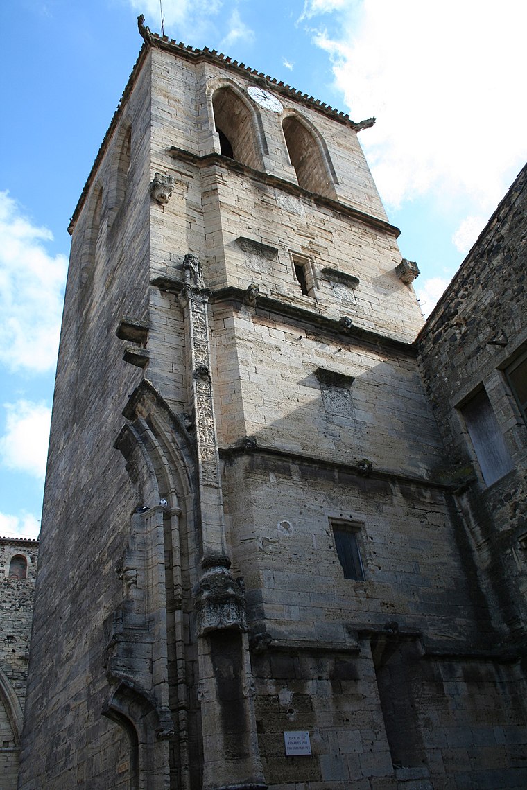
Photo: Fagairolles 34, CC BY-SA 4.0.
Église Saint-Thibéry de Saint-Thibéry is a church, which is situated 1¼ km north of Bip Information Professionnelle.
Places in the Area
Nearby places include Pomerols and Pézenas.
Pomerols

Photo: Fagairolles 34, CC BY-SA 4.0.
Pomérols is a commune in the Hérault department in the Occitanie region in southern France.
Pézenas

Photo: Christian Ferrer, CC BY-SA 4.0.
Pézenas is a commune in the Hérault department in the Occitanie region in southern France.
Marseillan
Village

Photo: Marseillan34340, CC BY-SA 4.0.
Marseillan is a resort town and commune in the Hérault department in southern France. As of 2022, the population of Marseillan is 8,047. The port of Marseillan is a protected heritage site, and the altar and organ in the church are also listed. Marseillan is situated 9 km east of Bip Information Professionnelle.
Bip Information Professionnelle
- Type: Building
- Location: Saint-Thibéry, Arrondissement of Béziers, Hérault, Occitanie, France, Europe
- View on OpenStreetMap
Latitude
43.38733° or 43° 23′ 14″ northLongitude
3.42262° or 3° 25′ 21″ eastOpen location code
8FM59CPF+W2OpenStreetMap ID
way 401675113OpenStreetMap feature
building=yes
This page is based on OpenStreetMap, Wikidata, and Wikimedia Commons.
We’d love your help improving our open data sources. Thank you for contributing.
Satellite Map
Discover Bip Information Professionnelle from above in high-definition satellite imagery.
Notable Places Nearby
Highlights include Communauté d’Agglomération Hérault-Méditerranée and Carrière des Roches Bleues.
Nearby Places
Explore places such as GMS Construction and Le Pin Parasol.
Hérault: Must-Visit Destinations
Delve into Montpellier, Béziers, Sète, and Bouzigues.
Curious Buildings to Discover
Uncover intriguing buildings from every corner of the globe.
About Mapcarta. Data © OpenStreetMap contributors and available under the Open Database License". Text is available under the CC BY-SA 4.0 license, except for photos, directions, and the map. Photo: Ondřej Žváček, CC BY 2.5.