Abbot Alphege Academy
Abbot Alphege Academy is a school in Bath and North East Somerset, England which is located on Beckford Drive. Abbot Alphege Academy is situated nearby to the recreation area Kingswood Upper School Playing Fields, as well as near the residential building Ensleigh House.| Tap on a place to explore it |
- Type: School
- Denomination: Anglican
- Description: school in Bath and North East Somerset, UK
- Address: Beckford Drive, Lansdown, BA1 9AU
Places of Interest Nearby
Highlights include Beckford’s Tower and Lansdown Cemetery.
Beckford’s Tower
Museum

Photo: Wikimedia, Public domain.
Beckford's Tower, originally known as Lansdown Tower, is an architectural folly built in neo-classical style on Lansdown Hill, just outside Bath, Somerset, England. Beckford’s Tower is situated 1,200 feet southwest of Abbot Alphege Academy.
Lansdown Cemetery
Cemetery

Photo: Daderot, Public domain.
Beckford's Tower, originally known as Lansdown Tower, is an architectural folly built in neo-classical style on Lansdown Hill, just outside Bath, Somerset, England. Lansdown Cemetery is situated 1,200 feet southwest of Abbot Alphege Academy.
Ensleigh House
Residential building

Photo: Ian Capper, CC BY-SA 2.0.
Ensleigh House is a residential building, which is situated 1,100 feet southeast of Abbot Alphege Academy.
Places in the Area
Nearby places include Charlcombe and Lansdown.
Charlcombe
Suburb
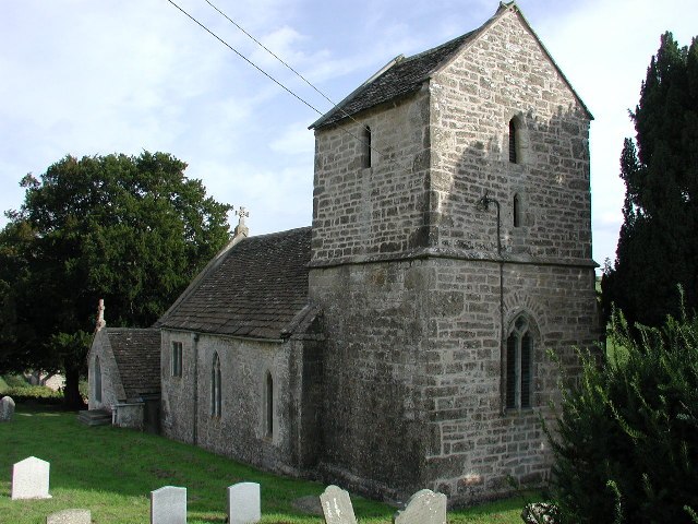
Photo: ChurchCrawler, CC BY-SA 2.0.
Charlcombe is a civil parish and small village just north of Bath in the Bath and North East Somerset unitary authority, Somerset, England. The parish had a population of 422 in 2011, and includes the villages of Woolley and Langridge and the hamlet of Lansdown.
Lansdown
Suburb

Photo: Virginia Knight, CC BY-SA 2.0.
Lansdown is a suburb of the World Heritage City of Bath, England, that extends northwards from the city centre up a road of the same name. Among its most distinctive architectural features are Lansdown Crescent and Sion Hill Place, which includes a campus…
Swainswick
Village

Photo: Sharon Loxton, CC BY-SA 2.0.
Swainswick is a small village and civil parish, 3 miles northeast of Bath, on the A46 in the Bath and North East Somerset unitary authority, Somerset, England.
Abbot Alphege Academy
- Categories: free school, primary school, and education
- Location: Bath and North East Somerset, England, United Kingdom, Britain and Ireland, Europe
- View on OpenStreetMap
Latitude
51.40842° or 51° 24′ 30″ northLongitude
-2.37491° or 2° 22′ 30″ westOperator
Comenius TrustOpen location code
9C3VCJ5G+92OpenStreetMap ID
way 448943272OpenStreetMap feature
amenity=schoolOpenStreetMap attribute
denomination=anglicanWikidata ID
Q66168512
This page is based on OpenStreetMap, Wikidata, and Wikimedia Commons.
We’d love your help improving our open data sources. Thank you for contributing.
Satellite Map
Discover Abbot Alphege Academy from above in high-definition satellite imagery.
Notable Places Nearby
Highlights include Kingswood Upper School Playing Fields and Bath Cricket Club (Brownsword Ground).
Nearby Places
Explore places such as Pemberley Place and Caterplus@Pemberley Place.
England: Must-Visit Destinations
Delve into London, Manchester, Sheffield, and Leeds.
Curious Places to Discover
Uncover intriguing places from every corner of the globe.
About Mapcarta. Data © OpenStreetMap contributors and available under the Open Database License". Text is available under the CC BY-SA 4.0 license, except for photos, directions, and the map. Photo: sidibousaid, CC BY 2.0.