Templo Santa Ana
Templo Santa Ana is a church in Almirante Brown Partido, Buenos Aires. Templo Santa Ana is situated nearby to the cemetery Campo Santo, as well as near the church Parroquia Santa Ana.| Tap on a place to explore it |
Places of Interest Nearby
Highlights include Glew station and Longchamps station.
Glew station
Railway station

Photo: Hurfer, CC BY-SA 4.0.
Glew station is a railway station, which is situated 220 metres north of Templo Santa Ana.
Longchamps station
Railway station

Photo: Hurfer, CC BY-SA 4.0.
Longchamps station is a railway station, which is situated 3½ km north of Templo Santa Ana.
Emilio Burgwardt Hospital
Hospital
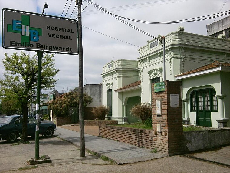
Photo: Wikimedia, CC BY-SA 3.0.
The Emilio Burgwardt Hospital is a hospital located in Longchamps, in the southern area of the Greater Buenos Aires. It is administered and owned by a civic society, Sociedad de Fomento Emilio Burgwardt. Emilio Burgwardt Hospital is situated 3½ km north of Templo Santa Ana.
Places in the Area
Nearby places include Glew and Guernica.
Glew
Town

Photo: BetacommandBot, CC BY-SA 4.0.
Glew is a city in southern Almirante Brown Partido, Buenos Aires Province, Argentina. Its municipal area of 17.65 km2 holds a population of 57,878. It is located 34 km from Buenos Aires city, and connected to it by the Ferrocarril General Roca.
Guernica
Town

Photo: Ulises Icardi, CC BY-SA 4.0.
Guernica is a localidad in Presidente Perón Partido of Buenos Aires Province, Argentina. It is the administrative centre for the partido. Guernica is situated on the outskirts of the Greater Buenos Aires urban conurbation around 30 km from the autonomous city of Buenos Aires. Guernica is situated 3 km south of Templo Santa Ana.
Longchamps
Town
Photo: Wikimedia, CC BY-SA 2.0.
Longchamps is a city in Greater Buenos Aires, Argentina, located about 30 km south of Buenos Aires, in the Almirante Brown Partido. The city is named for the race track of the same name located on the Route des Tribunes in the Bois de Boulogne at Paris, France, after which the Sociedad Hípica de Lomas de Zamora was inspired to name the city's own racecourse. Longchamps is situated 3½ km north of Templo Santa Ana.
Templo Santa Ana
- Type: Church
- Categories: building and religion
- Location: Almirante Brown Partido, Buenos Aires, Pampas, Argentina, South America
- View on OpenStreetMap
Latitude
-34.89063° or 34° 53′ 26″ southLongitude
-58.38406° or 58° 23′ 3″ westOpen location code
48Q34J58+P9OpenStreetMap ID
way 464638716OpenStreetMap feature
building=church
This page is based on OpenStreetMap, Wikidata, and Wikimedia Commons.
We’d love your help improving our open data sources. Thank you for contributing.
Satellite Map
Discover Templo Santa Ana from above in high-definition satellite imagery.
Places with the Same Name
Discover other places named “Templo Santa Ana”.
Notable Places Nearby
Highlights include Campo Santo and Parroquia Santa Ana.
Nearby Places
Explore places such as Escuela Primaria Nº 4 and Librería Parroquial.
Buenos Aires: Must-Visit Destinations
Delve into Buenos Aires, La Plata, Mar del Plata, and Centro.
Curious Churches to Discover
Uncover intriguing churches from every corner of the globe.
About Mapcarta. Data © OpenStreetMap contributors and available under the Open Database License". Text is available under the CC BY-SA 4.0 license, except for photos, directions, and the map. Photo: Mbusin, CC BY-SA 4.0.