Rockingham Arms Public House
Rockingham Arms Public House is a pub in Corby District, North Northamptonshire, England which is located on Studfall Avenue. Rockingham Arms Public House is situated nearby to the church St Columba & the Northern Saints, as well as near Corby Pentecostal Church.| Tap on a place to explore it |
Places of Interest Nearby
Highlights include Corby Cube and Corby East Midlands International Pool.
Corby Cube
Town hall

Photo: Cj1340, CC BY-SA 3.0.
Corby Cube is a municipal building in the town of Corby, Northamptonshire, England. Built in 2010, it is occupied by North Northamptonshire Council as its headquarters, but was originally built for Corby Borough Council. Corby Cube is situated 3,000 feet south of Rockingham Arms Public House.
Corby East Midlands International Pool
Sports venue
Corby East Midland International Swimming Pool is a sports facility located in Corby, Northamptonshire, England, which is owned and run by North Northamptonshire Council. Corby East Midlands International Pool is situated 2,700 feet south of Rockingham Arms Public House.
Corby railway station
Railway station

Photo: Tom walker, CC BY 3.0.
Corby railway station serves the town of Corby, in Northamptonshire, England. It is owned by Network Rail and managed by East Midlands Railway. The current station was opened on 23 February 2009, replacing the original entity which was open between 1879 and 1966; it had reopened temporarily between 1987 and 1990. Corby railway station is situated 1 mile southeast of Rockingham Arms Public House.
Places in the Area
Nearby places include Corby and Weldon.
Corby

Photo: Tom walker, CC BY 3.0.
Corby is a town and civil parish in North Northamptonshire, England, 23 miles northeast of Northampton. In 2021 it had a population of 68,164. From 1974 to 2021, it was the administrative headquarters of the Borough of Corby; at the 2021 Census, the former borough had a population of 75,571.
Weldon
Village

Photo: Richard Croft, CC BY-SA 2.0.
Weldon is a suburban village and civil parish on the eastern outskirts of Corby, Northamptonshire, England. It is two miles away from Corby. Weldon is situated 3 miles east of Rockingham Arms Public House.
Newton
Village
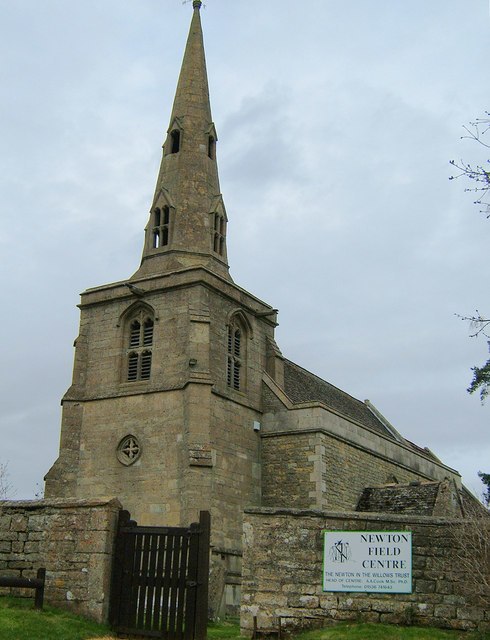
Photo: John Stolarski, CC BY-SA 2.0.
Newton, sometimes called Newton in the Willows, is a small village and former civil parish, now in the parish of Newton and Little Oakley, in the North Northamptonshire district, in the ceremonial county of Northamptonshire, England. Newton is situated 3½ miles south of Rockingham Arms Public House.
Rockingham Arms Public House
- Type: Pub
- Address: Studfall Avenue, Corby, NN17 1LQ
- Category: building
- Location: Corby District, North Northamptonshire, England, United Kingdom, Britain and Ireland, Europe
- View on OpenStreetMap
Latitude
52.49525° or 52° 29′ 43″ northLongitude
-0.70705° or 0° 42′ 25″ westOpen location code
9C4XF7WV+35OpenStreetMap ID
way 477231163OpenStreetMap feature
amenity=pubOpenStreetMap feature
building=yes
This page is based on OpenStreetMap, Wikidata, and Wikimedia Commons.
We’d love your help improving our open data sources. Thank you for contributing.
Satellite Map
Discover Rockingham Arms Public House from above in high-definition satellite imagery.
Notable Places Nearby
Highlights include St Columba & the Northern Saints and Corby Pentecostal Church.
Nearby Places
Explore places such as Strides of Studfall and Coral.
England: Must-Visit Destinations
Delve into London, Manchester, Sheffield, and Leeds.
Curious Pubs to Discover
Uncover intriguing pubs from every corner of the globe.
About Mapcarta. Data © OpenStreetMap contributors and available under the Open Database License". Text is available under the CC BY-SA 4.0 license, except for photos, directions, and the map. Photo: sidibousaid, CC BY 2.0.