Tümpel
Tümpel is in Grafenstein, Klagenfurt-Land District, Carinthia. Tümpel is situated nearby to the railway station Aufnahmsgebäude Bahnhof Grafenstein, as well as near the forest Pirker Schachterl.| Tap on a place to explore it |
Places of Interest Nearby
Highlights include Grafenstein and Aufnahmsgebäude Bahnhof Grafenstein.
Grafenstein
Town hall
Grafenstein is a town in the district of Klagenfurt-Land in the Austrian state of Carinthia. Grafenstein is situated 1¼ km southeast of Tümpel.
Aufnahmsgebäude Bahnhof Grafenstein
Railway station
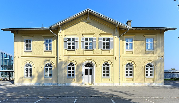
Photo: Johann Jaritz, CC BY-SA 3.0.
Aufnahmsgebäude Bahnhof Grafenstein is a railway station, which is situated 1 km southeast of Tümpel.
Pfarrhof Grafenstein
Public building

Photo: Johann Jaritz, CC BY-SA 3.0 at.
Pfarrhof Grafenstein is a public building, which is situated 2 km southeast of Tümpel.
Places in the Area
Nearby places include Tainach and Lipizach.
Tainach
Village

Photo: Naturpuur, CC BY-SA 4.0.
Tainach is a village, which is situated 7 km east of Tümpel.
Lipizach
Hamlet

Photo: Streunerich, CC BY-SA 4.0.
Lipizach is a hamlet, which is situated 7 km southwest of Tümpel.
Sankt Veit im Jauntal
Village

Photo: Streunerich, CC BY-SA 4.0.
Sankt Veit im Jauntal is a village, which is situated 8 km southeast of Tümpel.
Tümpel
- Type: Body of water
- Location: Grafenstein, Klagenfurt-Land District, Carinthia, Austria, Central Europe, Europe
- View on OpenStreetMap
Latitude
46.62516° or 46° 37′ 31″ northLongitude
14.45155° or 14° 27′ 6″ eastOpen location code
8FRPJFG2+3JOpenStreetMap ID
way 480214144OpenStreetMap feature
natural=water
This page is based on OpenStreetMap, Wikidata, and Wikimedia Commons.
We’d love your help improving our open data sources. Thank you for contributing.
Satellite Map
Discover Tümpel from above in high-definition satellite imagery.
Places with the Same Name
Discover other places named “Tümpel”.
Notable Places Nearby
Highlights include Bahnhof Grafenstein and Pirker Schachterl.
Nearby Places
Explore places such as Grafenstein Abzweigung Unterwuchel and Grafenstein Abzweigung Unterwuchel.
Carinthia: Must-Visit Destinations
Delve into Klagenfurt, Villach, Wörthersee, and Spittal an der Drau.
Curious Places to Discover
Uncover intriguing places from every corner of the globe.
About Mapcarta. Data © OpenStreetMap contributors and available under the Open Database License". Text is available under the CC BY-SA 4.0 license, except for photos, directions, and the map. Photo: Wikimedia, CC BY-SA 3.0.