Vrije Basisschool Sint-Mauritius
Vrije Basisschool Sint-Mauritius is a school in Bilzen-Hoeselt, Arrondissement of Tongeren, Flanders which is located on Kloosterwal. Vrije Basisschool Sint-Mauritius is situated nearby to the grassland Demervallei, as well as near the deciduous forest Brongebied Tabaart.| Tap on a place to explore it |
Places of Interest Nearby
Highlights include Sint-Mauritiuskerk and Park Haffmans.
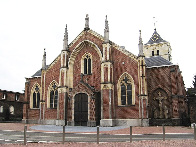
Sint-Mauritiuskerk
Church

Photo: Sonuwe, CC BY-SA 3.0.
Sint-Mauritiuskerk is a church, which is situated 270 metres southwest of Vrije Basisschool Sint-Mauritius.
Park Haffmans
Park
 Park Haffmans is situated 620 metres southwest of Vrije Basisschool Sint-Mauritius.
Bilzen railway station
Railway station

Photo: Sonuwe, CC BY-SA 3.0.
Bilzen railway station is situated 1 km southwest of Vrije Basisschool Sint-Mauritius.
Places in the Area
Nearby places include Bilzen and Merem.
Bilzen
Town

Photo: Geert Budenaerts, CC BY 3.0.
Bilzen is a former municipality and city located in the Belgian province of Limburg. In 2021, Bilzen had a total population of 32,536. The total area is 75.90 km.
Vrije Basisschool Sint-Mauritius
- Type: School
- Address: Kloosterwal 10
- Category: education
- Location: Bilzen-Hoeselt, Arrondissement of Tongeren, Limburg, Flanders, Belgium, Benelux, Europe
- View on OpenStreetMap
Latitude
50.87162° or 50° 52′ 18″ northLongitude
5.52117° or 5° 31′ 16″ eastOpen location code
9F27VGCC+JFOpenStreetMap ID
way 615876016OpenStreetMap feature
amenity=school
This page is based on OpenStreetMap, Wikidata, and Wikimedia Commons.
We’d love your help improving our open data sources. Thank you for contributing.
Satellite Map
Discover Vrije Basisschool Sint-Mauritius from above in high-definition satellite imagery.
Notable Places Nearby
Highlights include Demervallei and Brongebied Tabaart.
Nearby Places
Explore places such as Carrefour Market and Kloosterwal.
Limburg: Must-Visit Destinations
Delve into Sint-Truiden, Hasselt, Tongeren, and Genk.
Curious Schools to Discover
Uncover intriguing schools from every corner of the globe.
About Mapcarta. Data © OpenStreetMap contributors and available under the Open Database License". Text is available under the CC BY-SA 4.0 license, except for photos, directions, and the map. Photo: Paul Hermans, CC BY-SA 3.0.