C’est la fête
C’est la fête is a retail building in Nouvelle-Aquitaine, France. C’est la fête is situated nearby to the health club CrossFit, as well as near the cemetery Cimetière du Bourg.| Tap on a place to explore it |
Places of Interest Nearby
Highlights include Église Saint-Jean-Baptiste de Lons and Lescar Cathedral.
Église Saint-Jean-Baptiste de Lons
Church

Photo: Peter17, CC BY-SA 4.0.
Église Saint-Jean-Baptiste de Lons is a church, which is situated 740 metres southeast of C’est la fête.
Lescar Cathedral
Church

Photo: Flo641, CC BY-SA 3.0.
Lescar Cathedral is a Roman Catholic church and former cathedral dedicated to the Assumption of the Virgin Mary. It is located in the town of Lescar, Pyrénées-Atlantiques, France. Lescar Cathedral is situated 1½ km northwest of C’est la fête.
Église Saint-Julien de Lescar
Church

Photo: Capbourrut, CC BY-SA 4.0.
Église Saint-Julien de Lescar is a church, which is situated 1½ km northwest of C’est la fête.
Places in the Area
Nearby places include Lons and Lescar.
Lons
Town

Photo: France64160, CC0.
Lons is a commune in the Pyrénées-Atlantiques department in south-western France. It is a northwestern suburb of Pau.
Lescar
Village
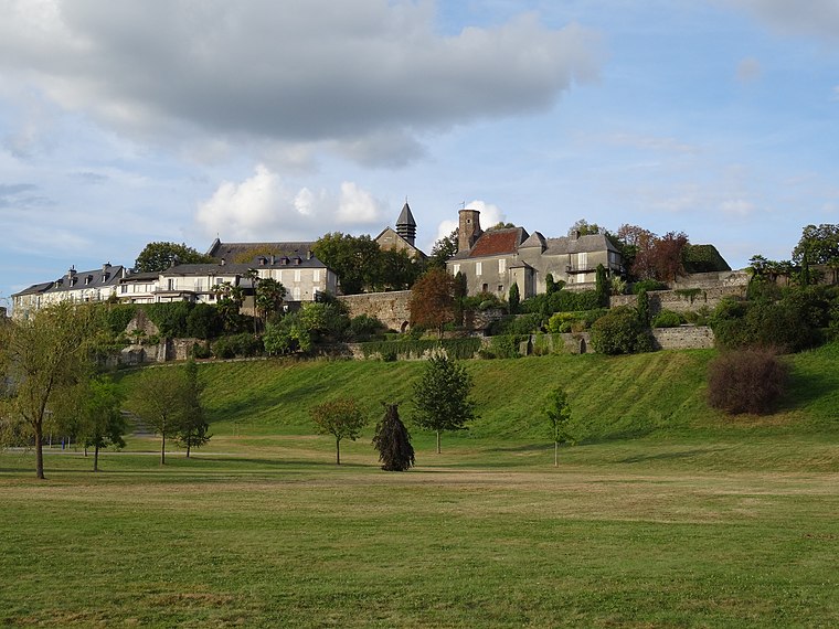
Photo: Flo641, CC BY-SA 4.0.
Lescar is a commune in the Pyrénées-Atlantiques department and Nouvelle-Aquitaine region of south-western France. Lescar is the site of the Roman city known variously as Benearnum, Beneharnum or Civitas Benarnensium, the location providing the name for the later region of Béarn.
Laroin
Village

Photo: France64160, CC0.
Laroin is a commune in the Pyrénées-Atlantiques department in south-western France.
C’est la fête
- Type: Retail building
- Category: building
- Location: Nouvelle-Aquitaine, France, Europe
- View on OpenStreetMap
Latitude
43.32082° or 43° 19′ 15″ northLongitude
-0.42137° or 0° 25′ 17″ westOpen location code
8CMX8HCH+8FOpenStreetMap ID
way 63536026OpenStreetMap feature
building=retail
This page is based on OpenStreetMap, Wikidata, and Wikimedia Commons.
We’d love your help improving our open data sources. Thank you for contributing.
Satellite Map
Discover C’est la fête from above in high-definition satellite imagery.
Notable Places Nearby
Highlights include CrossFit and Cimetière du Bourg.
Nearby Places
Explore places such as Meuble - Recyclerie and Cash 31.
Nouvelle-Aquitaine: Must-Visit Destinations
Delve into Bordeaux, Deux-Sèvres, Charente, and Poitiers.
Curious Retail Buildings to Discover
Uncover intriguing retail buildings from every corner of the globe.
About Mapcarta. Data © OpenStreetMap contributors and available under the Open Database License". Text is available under the CC BY-SA 4.0 license, except for photos, directions, and the map. Photo: Larrousiney, CC BY-SA 3.0.