Tochtebrug
Tochtebrug is a bridge in Hoorn, North Holland Peninsula, North Holland. Tochtebrug is situated nearby to the health club Beverly Gym, as well as near the grassland Voormalige heemtuin.| Tap on a place to explore it |
Places of Interest Nearby
Highlights include Hof van Hoorn and Dijklander Ziekenhuis, Hoorn.
Hof van Hoorn
Shopping center

Photo: Dqfn13, CC BY-SA 4.0.
Hof van Hoorn is a shopping center, which is situated 310 metres southwest of Tochtebrug.
Dijklander Ziekenhuis, Hoorn
Hospital

Photo: Wikimedia, CC BY-SA 3.0.
Dijklander Ziekenhuis, Hoorn is a hospital, which is situated 520 metres south of Tochtebrug.
Hoorn railway station
Railway station
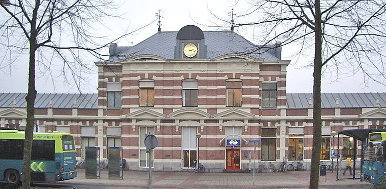
Photo: T Houdijk, CC BY-SA 3.0.
Hoorn is the main railway station of the town of Hoorn, Netherlands. Hoorn railway station is situated 1 km south of Tochtebrug.
Places in the Area
Nearby places include Zwaag and Zwaagdijk-West.
Zwaag
Village

Photo: Muriel32, Public domain.
Zwaag is a village in the Netherlands. It is located in the municipality of Hoorn, the province of North Holland and the region of West Friesland.
Zwaagdijk-West
Village
Zwaagdijk-West is a village in the Dutch province of North Holland. It is a part of the municipality of Medemblik, and lies about 3 km north of Hoorn. The village was first mentioned in 1319 as buten den Zuoechdyc, and means "the dike belonging to Zwaag. Zwaagdijk-Oost is the settlement on the eastern side of the dike, Zwaagdijk-West is on the western side. Zwaagdijk-West is situated 2½ km north of Tochtebrug.
Blokker
Village
Blokker is a village in the northwest Netherlands, in the province of North Holland and the region of West Friesland. Blokker is situated 2½ km east of Tochtebrug.
Tochtebrug
- Type: Bridge
- Category: transportation
- Location: Hoorn, North Holland Peninsula, North Holland, Western Netherlands, Netherlands, Benelux, Europe
- View on OpenStreetMap
Latitude
52.65247° or 52° 39′ 9″ northLongitude
5.05296° or 5° 3′ 11″ eastOpen location code
9F47M323+X5OpenStreetMap ID
way 720155250OpenStreetMap feature
man_made=bridge
This page is based on OpenStreetMap, Wikidata, and Wikimedia Commons.
We’d love your help improving our open data sources. Thank you for contributing.
Satellite Map
Discover Tochtebrug from above in high-definition satellite imagery.
Notable Places Nearby
Highlights include Beverly Gym and Voormalige heemtuin.
Nearby Places
Explore places such as Leen Bakker and Verwilderde appelbomen.
North Holland Peninsula: Must-Visit Destinations
Delve into Alkmaar, Den Helder, Enkhuizen, and Castricum.
Curious Bridges to Discover
Uncover intriguing bridges from every corner of the globe.
About Mapcarta. Data © OpenStreetMap contributors and available under the Open Database License". Text is available under the CC BY-SA 4.0 license, except for photos, directions, and the map. Photo: Gerd W. Zinke, CC BY-SA 3.0.